Smart offline map
-
Product architecture -
Product advantages -
Product Functions -
Application scenarios -
Customer Stories -
Related products -
contact us
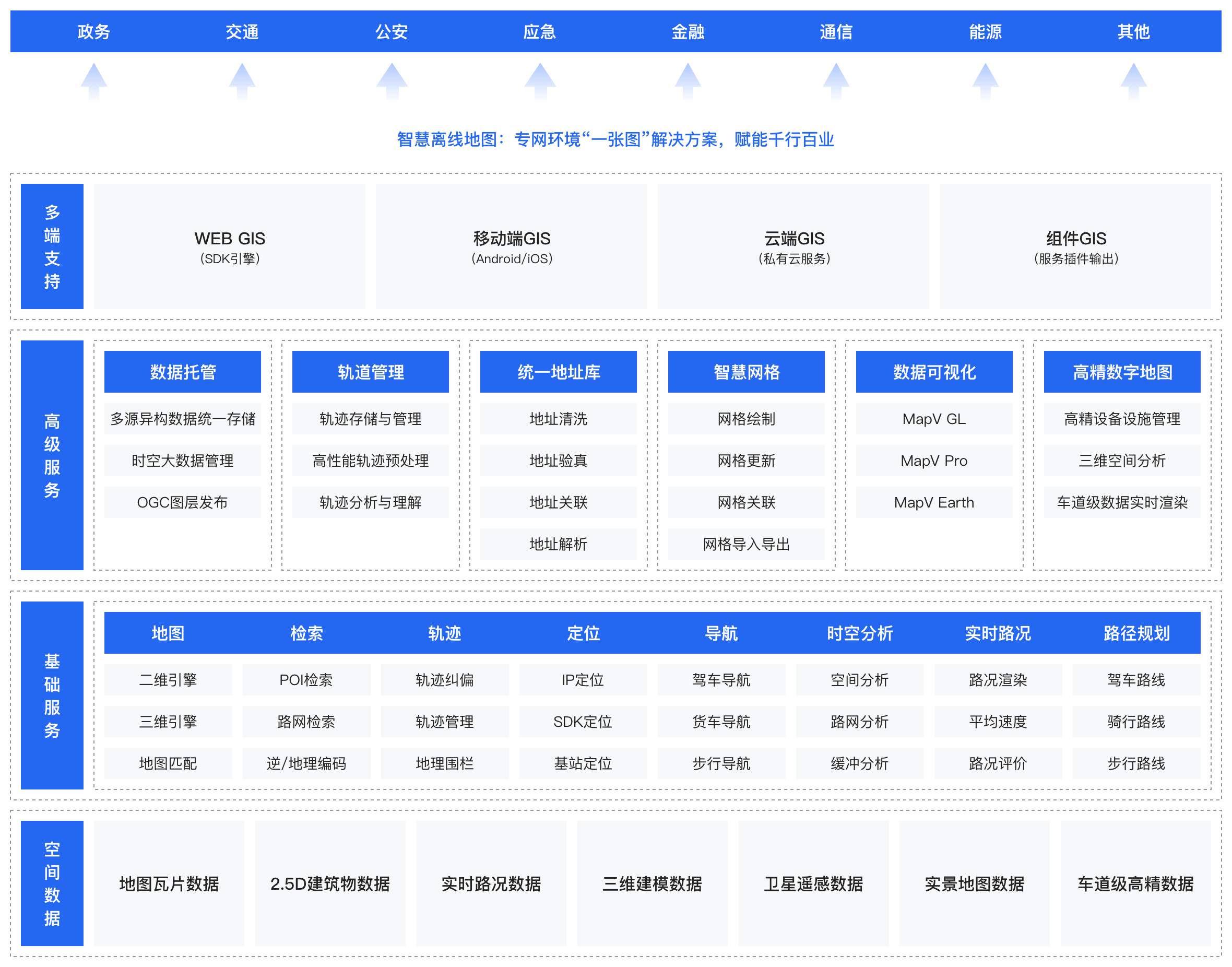
Product architecture
Build the digital base of artificial intelligence map, and provide the government and enterprises with 2D and 3D integrated GIS data and engine services under the private network environment.
Product advantages
With massive dynamic data -
POI data, road network data, real-time road condition data, vehicle flow track data
-
Beautiful and useful map development service -
Provide private network map services consistent with the Internet, help developers reduce secondary development costs, and achieve a "ready to use" development experience
-
Strong technical support and flexible deployment -
Support one click deployment, private cloud and multiple hardware environment deployment, and unparalleled concurrent response, rendering and storage performance
-
Reproducing the living map of the real world -
Top AI technology map data production team, 90% of data production links have achieved AI
-
Product Functions
Permission control platform
Offline map engine
Mobile terminal map SDK
Spatio temporal data management platform
Intelligent grid management platform
Track management engine
Digital twin map
Traffic big data analysis interface service
Urban population geography big data analysis interface service
Application scenarios
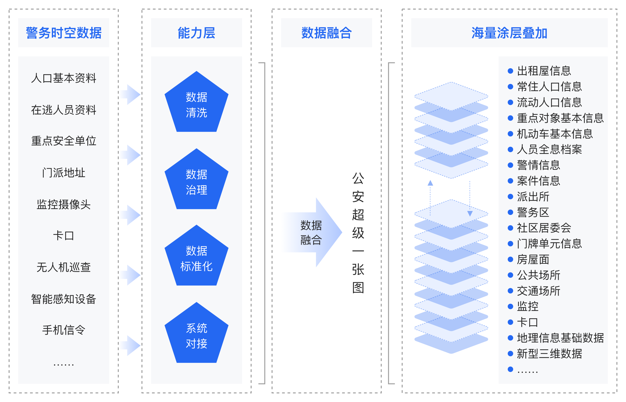
Smart Public Security Super Map
We can provide
Massive and far map spatial data
Multi source heterogeneous data fusion technology
Related products
Customer Stories
Related products
Partner communication