Intelligent grid management
-
Product advantages -
Product advantages -
Product Functions -
Application scenarios -
contact us
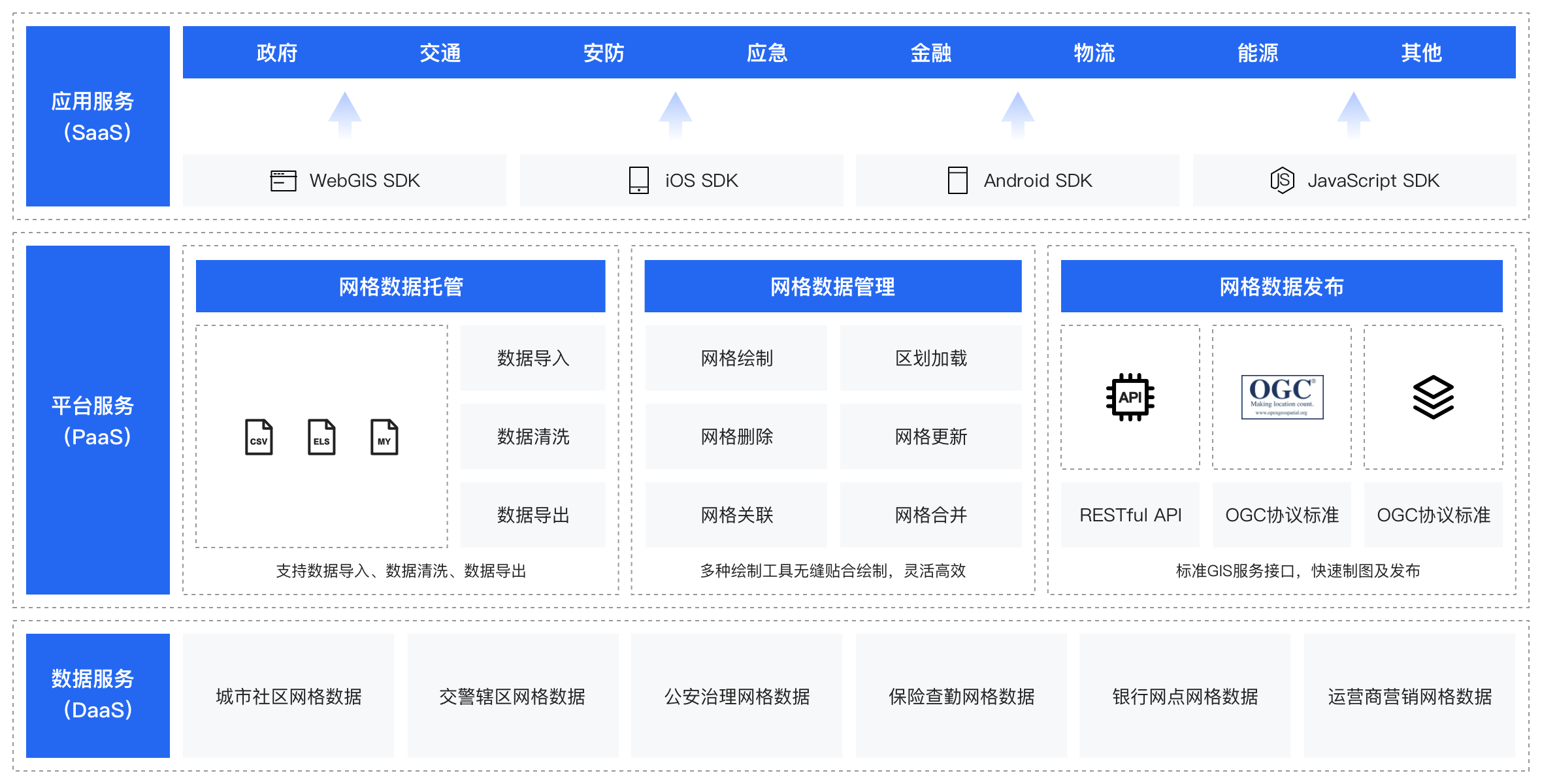
Product description
The intelligent grid management platform helps government and enterprise customers build refined grid maps by introducing Baidu map data and providing efficient and flexible grid mapping services
Product advantages
Convenient custom gridding
Efficient multi-level grid management
Flexible grid experience
Product Functions
Mesh drawing, boundary correction Support the drawing of rectangular, circular and custom polygon meshes, and support the secondary correction of mesh boundaries. Load Administrative Division It integrates the boundary information of the four administrative divisions of the country, and can generate a grid based on administrative regions with one click. Boundary point line adsorption If the boundary point is very close to the boundary of the historical grid, the new boundary point will be automatically attached to the historical boundary to ensure that the adjacent grids "fit together". Dual view grid management It provides two grid visualization forms, list view and map view, to make grid management more intuitive. Associative grid Multiple grids can be associated with one key to establish a grid relationship tree, helping customers easily manage multi-level grids. Import Export Support grid file import and export. The grid can be drawn once and reused in multiple businesses, systems and scenarios.
Application scenarios
Precision marketing
We can provide
Grid data On the basis of enriching spatial plane data and line data of administrative divisions, AOI, road networks, etc., the foundation of basic grid data generation is laid. Cost reduction and efficiency increase The work of customers and order distribution is more intensive. Personalized service Different types of grid divisions can be generated for different scenarios and business demands.
Related products

Partner communication