Spatio temporal data management platform
-
Product architecture -
Product Functions -
Product advantages -
Application scenarios -
Customer Stories -
Related products
Product architecture
The spatiotemporal big data technology is used to realize the fusion storage of multi-source spatiotemporal data, provide rich data aggregation, data governance management and service release capabilities, improve the efficiency of spatiotemporal data asset management, and fully exploit the value of data.
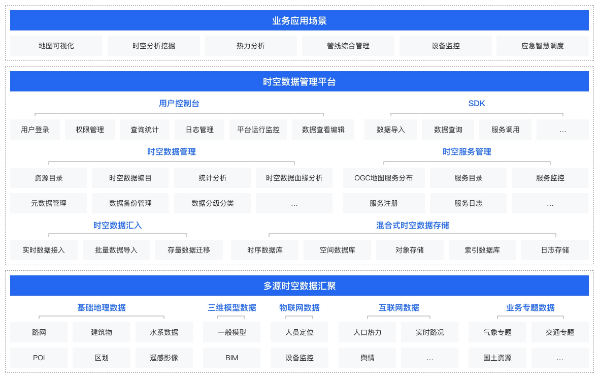
Product Functions
Spatio temporal data access -
Support the access of multi-source heterogeneous spatiotemporal data, and adopt the hybrid storage architecture design to realize the integrated storage of spatiotemporal data
-
Spatio temporal data governance -
Provide format conversion, projection transformation, spatial processing and other functions to manage spatio-temporal data and form standardized data assets
-
Unified management of spatio-temporal data -
The platform management mode is adopted to realize the unified management of multi-source spatio-temporal data, providing functions including spatio-temporal resource directory, spatio-temporal data query and statistics, spatio-temporal metadata management, etc
-
Service release and management -
Based on spatio-temporal data storage, it provides OGC standard 2D and 3D service publishing capabilities, including WFS, WMS, 3D Tiles and other types, supporting data visualization and business applications
-
Product advantages
Multi source data fusion
Spatiotemporal analysis
Massive data support
Ecological compatibility
Application scenarios
Urban lifeline smart pipe network
We can provide
Pipeline data fusion storage: warehousing and storage of urban pipe network digital achievement data; Realize integrated storage of pipeline data and business thematic data; Provide spatial topology analysis: provide spatial topology analysis capability to support pipeline flow direction analysis, upstream and downstream analysis, excavation analysis, etc 3D pipeline visualization: provide efficient storage of pipeline model data and support 3D pipeline rendering services

Customer Stories
State Power Investment Group Dongfang New Energy Three Network Integration

A picture of Yuntianhua mapping formula
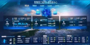
Lijiang City Brain