Uploaded on: 2020-09-04 19:59:45 come from: Road and bridge municipal administration / Road and bridge works / Tunnel works
zero
3 points

Yuwangling Tunnel is located on the south side of Asoka Temple, National Highway 329. The eastern section of the tunnel belongs to Beilun District, and the western section belongs to Yinzhou District. It is part of the interval between Baochuang Station and Wuai Station. The tunnel entrance mileage is K30+730 on the right, and the exit mileage is K32+110 on the right, with a total length of 1380 meters. The tunnel entrance section K30+730~765 is mainly composed of silty clay containing crushed stones, and the local exposure is strongly weathered and moderately weathered fused tuff. The stability of the upper soil slope section is poor, and the lower rock slope section is basically stable. The tunnel exit section K31+965~K32+75 is mainly composed of gravelly silty clay, strongly weathered rhyolite, moderately weathered rhyolite and fault fracture zone. The rock mass is relatively broken, with cataclastic structure, strong weathering, blind joints and fissures, and poor self stability. The entrance and exit section belongs to Class V shallow buried section, which is a difficulty in construction.

 Tunnel excavation and initial support construction scheme - Figure 1

Tunnel excavation and initial support construction scheme - Figure 1

 Tunnel excavation and initial support construction scheme - Figure 2

Tunnel excavation and initial support construction scheme - Figure 2

 Tunnel excavation and initial support construction scheme - Figure 3

Tunnel excavation and initial support construction scheme - Figure 3

 Tunnel excavation and initial support construction scheme - Figure 4

Tunnel excavation and initial support construction scheme - Figure 4

 Tunnel excavation and initial support construction scheme - Figure 5

Tunnel excavation and initial support construction scheme - Figure 5

Click to download the source file now

Special statement: This material belongs to the sharing uploaded by users Downloaded content, only for learning, not for commercial use. If there is any copyright problem, please timely contact Station delete!

Collection
share

WeChat code scanning and sharing

Click to share

  • Special construction of the first piece of tunnel excavation programme
    This contract section is the second contract section of Majitang Anhua Expressway, located in Anhua County, Yiyang City, starting from K9+260 (ZK9+263.624), Yunling Village, Yangjiaotang Town, Anhua County, and ending at K20+040, Jinhu Village, Lengshi Town, Anhua County, with a total length of 10.781km. Chixi Tunnel is located in Yeyatang Village, Anhua County. The landform is low mountain and hilly. The terrain along the tunnel fluctuates greatly. The maximum elevation of the mountain top is 310.00m, the maximum burial depth of the tunnel is about 117.49m, the natural gradient of the front slope at the east gate of Majitang end is about 40~45 °, and the natural gradient of the front slope at the portal of Anhua end is 20~30 °. The vegetation on the mountain surface of the tunnel is very developed, mainly including miscellaneous trees and shrubs. Chixi Tunnel is a separate tunnel on the left and right lines. The stake number of the left tunnel is ZK13+592 ~ ZK14+548, and the length is 956m, including 170m of Grade III surrounding rock, 560m of Grade IV surrounding rock, and 216m of Grade V surrounding rock; The stake number of the right tunnel is K13+595 ~ K14+555, with a length of 960m, including 170m for Grade III surrounding rock, 545m for Grade IV surrounding rock, and 225m for Grade V. Separate composite lining is adopted for tunnel design; The tunnel portal is designed as a bamboo cut portal.
  • Special construction of highway reconstruction tunnel excavation programme Word
    Huangxi Tunnel is located in Bashan, Chengkou County, with the starting and ending stake numbers of K17+790 ~ K18+440 and a total length of 650m; The designed pavement elevation is 729.259m. Longitudinal gradient - 2.0%. The tunnel interface size adopts the form of three center circle inner contour, the tunnel span is 7.68m, the tunnel height is 6.2m, and it is a single tunnel two-way Class IV highway tunnel. The design running speed is 20km/h; Tunnel construction clearance:
  • Special construction of tunnel excavation programme (Full content+typesetting)
    Jinshan Tunnel is located at * * Mountain, * * Town, * * County, * * City. It is a separate tunnel on the expressway from * * to * * connection line of the expressway network in the economic zone on the west side of the Straits - Anxi section of Quanzhou. The design load class is highway I. Jinshan Tunnel belongs to hilly landform with large topographic relief. The natural slope gradient at the entrance and exit is about 23~33 °. The surrounding rock of the tunnel body is tuff lava of Jurassic Nanyuan Formation, which belongs to hard rock. The rock mass is generally relatively complete, which is favorable to the stability of the surrounding rock of the tunnel body. The stability of the surrounding rock of the tunnel portal is poor, so support and detection measures should be strengthened during excavation. The left track of Jinshan Tunnel starts and ends at ZK8+708.04~ZK10+688.00 with a length of 1979.96m, including 196m for Grade V surrounding rock, 245m for Grade IV surrounding rock, 546m for Grade III surrounding rock, 993m for Grade II surrounding rock, and 1940m for the right track, including 148m for Grade V surrounding rock, 247m for Grade IV surrounding rock, 545m for Grade III surrounding rock, and 1000m for Grade II surrounding rock.
  • Construction of separate tunnel excavation programme
    The proposed tunnel is designed as a separate tunnel, crossing the mountain from northeast to southwest. Both sides of the mountain basically pass along the valley slope. The entrance end is located on the mountain slope inclined to northeast, with steep terrain and gradient of 20 °~30 °; The outlet end is located at the foot of the mountain slope inclined to the southwest, which is the edge of the riverbed in the valley. The left line starts and ends at the stake number of KH148+714~KH152+522, with a design length of 3808m, and the right line starts and ends at the stake number of KG148+711~KG152+508, with a design length of 3797m and a maximum burial depth of 390m.
  • Special construction of tunnel excavation programme
    Bailongshan Tunnel is located in Yushe Township, Shuicheng County, Liupanshui City. It is a separate tunnel with a total length of 4025m and a maximum buried depth of 328m. Our bid section is the second half of Bailongshan Tunnel. The exit portal of Duge section is end wall type. The starting and ending stakes of the right line are K202+650-K204+675, with a total length of 2025m. The exit section is curve R-900, and the longitudinal slope is -1.54%; The left line starts and ends at ZK202+590-ZK204+600, with a total length of 2010m. The exit section is curve R-960, with a longitudinal slope of -1.54%; The tunnel exit section is 14-53m deep, and the support inside the tunnel is strengthened. The pipe shed on the right line is 28m long, and the pipe shed on the left line is 40m long. The front slope of the portal is protected by hanging nets, anchoring and shotcreting. The overburden at the exit of Bailongshan Tunnel is broken residual gravelly soil, and the rock mass is broken. The surrounding rock is moderately weathered limestone,. The rock mass is in cataclastic structure, with strong water permeability, and belongs to weak rock. The surrounding rock has no self stabilization ability and is easy to collapse. The rock and soil stability of the front slope is poor and easy to slide down.
  • Changtian Tunnel excavation construction project programme
    Changtian Tunnel is a separate tunnel. The starting and ending points of the left line are ZK126+605 ~ ZK127+058, 453m long. The entrance open cut tunnel is 18m long, the exit open cut tunnel is 16m long, the Class V surrounding rock is 133m long, the Class IV surrounding rock is 87m long, and the Class III surrounding rock is 233m long; The stake number of the starting and ending points of the right line is K126+624 ~ K127+060, 436m long. The length of the open cut tunnel at the entrance is 18m, the length of the open cut tunnel at the exit is 18m, the length of the Class V surrounding rock is 106m, the length of the Class IV surrounding rock is 97m, and the length of the Class III surrounding rock is 233m.
  • Special construction of tunnel excavation programme (Full content+typesetting)
    Jinshan Tunnel is located at * * Mountain, * * Town, * * County, * * City. It is a separate tunnel on the expressway from * * to * * connection line of the expressway network in the economic zone on the west side of the Straits - Anxi section of Quanzhou. The design load class is highway I. Jinshan Tunnel belongs to hilly landform with large topographic relief. The natural slope gradient at the entrance and exit is about 23~33 °. The surrounding rock of the tunnel body is tuff lava of Jurassic Nanyuan Formation, which belongs to hard rock. The rock mass is generally relatively complete, which is favorable to the stability of the surrounding rock of the tunnel body. The stability of the surrounding rock of the tunnel portal is poor, so support and detection measures should be strengthened during excavation. The left track of Jinshan Tunnel starts and ends at ZK8+708.04~ZK10+688.00 with a length of 1979.96m, including 196m for Grade V surrounding rock, 245m for Grade IV surrounding rock, 546m for Grade III surrounding rock, 993m for Grade II surrounding rock, and 1940m for the right track, including 148m for Grade V surrounding rock, 247m for Grade IV surrounding rock, 545m for Grade III surrounding rock, and 1000m for Grade II surrounding rock.
  • Special construction of tunnel excavation programme (Full content+typesetting)
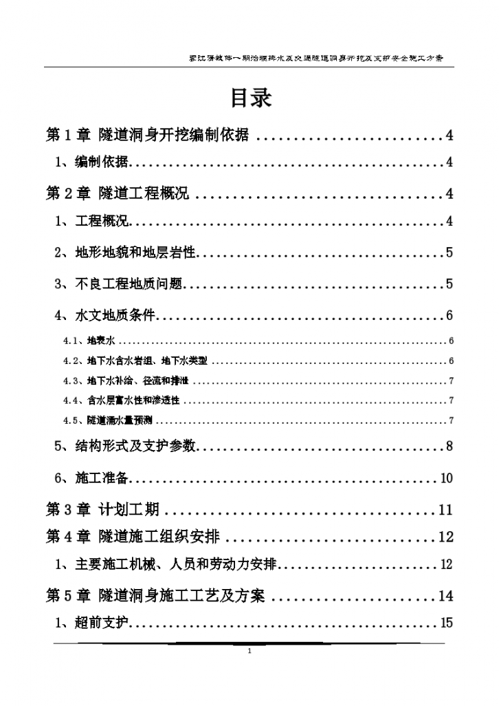
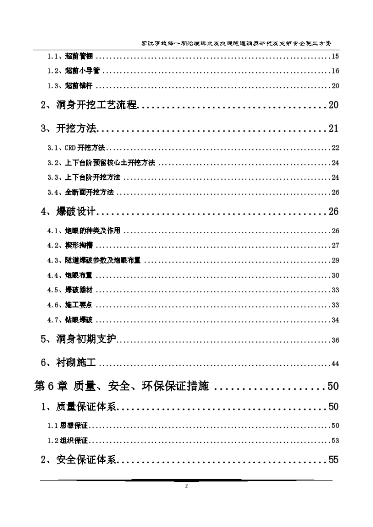
    Catalog I, project introduction 1 II, construction organization 1 2.1 Construction period 1 2.2 Construction preparation 2 2.3 Power supply, water supply, air supply, ventilation, smoke exhaust and construction drainage for tunnel construction 4 III, construction scheme and process 7 3.1 Construction method 7 3.2 Tunnel body construction 8 IV Monitoring measurement 26 4.1 Monitoring measurement purpose 26 4.2 Monitoring measurement plan content 27 4.3 Advance geological prediction 27 V. Tunnel construction safety emergency plan 28 5.1 Establishment of emergency handling mechanism 28 5.2 Personnel training and drill 28 5.3 Emergency materials and equipment storage 28 5.4 Emergency response 29 5.5 Construction safety emergency plan measures 29 VI Quality assurance system and construction period assurance measures 35 6.1 Measures to ensure project quality 35 6.2 Construction period assurance measures 37 VII. Safety assurance system and measures 37 7.1 Safety assurance measures 37 7.2 Safety assurance system 38 VIII Environmental protection measures 39 8.1 Objectives of ecological environment protection and water and soil conservation 39 8.2 Environmental protection and water and soil conservation scheme 39 8.3 Ecological environment protection measures 39 9.3 Energy conservation and emission reduction measures 41 IX. Civilized construction measures 41 9.1 Civilized construction measures 41 9.2 Measures to ensure clean and orderly construction site 42 9.3 Measures to live in harmony with local residents 42
  • Tunnel excavation and primary support construction programme (Page 61)
    a、 Code for Design of Metro (GB50157-2003) b, Code for Construction and Acceptance of Metro Engineering (GB50299-1999) c, Technical Code for Waterproofing of Underground Engineering (GB50108-2008) d, Unified Standard for Construction Quality Acceptance of Building Engineering (GB50300-2001) e, Code for Construction Quality Acceptance of Concrete Structures (GB50204-2002) f Technical Code for Anchor Bolt Shotcrete Support (GB50086-2001)
  • Tunnel advance support and tunnel excavation programme (41 pages) Word
    In order to strengthen the safety technology management during the excavation construction of the tunnel body, achieve the overall management goal of construction safety, prevent construction safety accidents, and ensure personal and property safety, this construction scheme is prepared according to the key points of standardization implementation in Gansu Province, which is used to guide the advance support and excavation construction of Shiyao Village Tunnel 2.
  • Special construction of tunnel excavation programme (45 full pages) Word
    Jinshan Tunnel is located at * * Mountain, * * Town, * * County, * * City. It is a separate tunnel on the expressway from * * to * * connection line of the expressway network in the economic zone on the west side of the Straits - Anxi section of Quanzhou. The design load class is highway I.
  • Special construction for initial support of tunnel body excavator programme
    The length and form of the tunnel, and the main surrounding rock grade. The vehicle crosswalk and pedestrian crosswalk are arranged. Tunnel construction clearance, height of construction clearance. Tunnel construction clearance of emergency parking area, height of construction clearance. Construction clearance of crosswalk. Clearance of pedestrian crossing tunnel.
  • Inspection Record of Tunnel Excavation
    This data is the excavation inspection record of a tunnel body. The contents are complete and can be downloaded
  • Blasting Design for Excavation of Xishan Tunnel programme
    This paper summarizes the experience of Xishan tunnel blasting construction, and expounds some basic measures that should be taken in the tunnel blasting excavation construction.
  • Tunnel body excavation at the left entrance of Hanzhang Tunnel programme
    Hanzhang Tunnel is located in the north of Hanzhang Village, Zijingguan Town, Yixian County, and Baijiazhuang Tunnel is located in the north of Baijiazhuang Village, Zijingguan Town, Yixian County. There is a provincial road near the two tunnels and a simple road to the entrance, which can be used by cars. The transportation is convenient. Both tunnels are separated two lane one-way expressway tunnels. The left range of Hanzhang Tunnel is LK69+202~LK71+650, 2448m long.
  • Special construction of Aiba tunnel lining programme
    This construction scheme focuses on "detailed description, easy understanding, easy acceptance, safety and quality assurance", and is prepared in accordance with the guiding ideology of "feasible construction scheme, advanced construction technology, reasonable construction organization, appropriate measures and strong guarantee" and the following principles.
  • Excavation and initial support construction of concealed excavation section of auxiliary works of a station programme

    This data is the construction plan for the excavation and initial support of the concealed excavation section of the auxiliary works of a station, which is detailed and can be used for reference.

  • Excavation of a spillway tunnel programme
    The excavation method is one of the important factors affecting the stability of surrounding rock in the tunnel construction. Therefore, when selecting the excavation method, comprehensive analysis should be made on the relevant factors such as the size and shape of the tunnel section, engineering geological conditions of surrounding rock, support conditions, construction period requirements, section length, mechanical equipment capacity, and economy, and appropriate excavation methods should be adopted
  • Three level technical disclosure of Xiangka tunnel excavation
    Construction technology, construction methods, precautions, quality control standards, process acceptance and signing system of Xiangka Tunnel excavation
  • Special construction of Aiba tunnel lining programme
    Aiba Tunnel is a separated long tunnel, with the starting and ending stake numbers of ZK22+280 ~ ZK23+430 on the left line, and the total length of 1150m, including 900m of Grade IV surrounding rock and 240m of Grade V surrounding rock; The starting and ending stake numbers of the right line are YK22+280 ~ YK23+480, with a total length of 1200m, including 930m for Grade IV surrounding rock and 260m for Grade V surrounding rock; The portal type is end wall type, and 5m open cut tunnel is designed. In addition, it includes 1 crosswalk for vehicles, 2 crosswalks for people and 2 emergency parking lots. The project area belongs to the humid climate of the mid subtropical monsoon. The annual average temperature is between 13 and 17 degrees centigrade, and the frost free period is 295 days. The average temperature in the coldest month (January) is about 5 degrees centigrade, and the average temperature in the hottest month (July) is about 23 degrees centigrade. Generally, there is a lot of rainfall from May to July and October. The meteorological conditions cause the short effective construction period every year.
  • Special construction for tunnel excavation programme (Revised)
    YQZQ-10 The starting and ending mileage of our department is D1K239+355.98~D1K290+554.27, which is located between Goujiang, Zunyi City and Xifeng County, Guiyang City. The main line is 51.198km long. It includes 26 tunnels with a total length of 17545m. It belongs to the central and eastern edge of Yunnan Guizhou Plateau, with an altitude of 800-1000m. It is a karst landform area with many karst. The overburden is Quaternary slope eluvial rock (Q4dl+el) red clay, underlain by Triassic middle Songzikan Formation (T2s) dolomite. The seismic peak acceleration is less than 0.05g, and the characteristic period of the seismic response spectrum is 0.35s.
  • Treatment of deformation and arch replacement of tunnel invert programme
    The original design of DK24+890 ~ DK25+310 mileage section of tunnel adopts IV grade surrounding rock composite lining. The initial arch wall adopts grid steel frame with spacing of 1.5m/truss. The thickness of the secondary lining is 30cm. The secondary lining adopts concrete structure. The original design of DK25+310~DK25+380 Class IV surrounding rock section adopts Class IV surrounding rock reinforced composite lining. The initial arch wall adopts grid steel frame with a spacing of 1.2m/truss, the thickness of the secondary lining is 35cm, and the secondary lining adopts concrete structure. Grade V reinforced composite lining is used for DK24+852~DK24+890 and DK25+380~DK25+409 sections. I-18 steel frame is used for initial support with a spacing of 0.8m/truss, and reinforced concrete structure is used for the secondary lining. The tunnel body passes through sandstone and mudstone interbedding, fault fracture zone, mudstone with weak expansion, and overall poor geological conditions.
  • Excavation and initial support construction of a station and section tunnel of Chongqing Rail Transit Line 6 programme
    Xxx station is a transfer station. The starting mileage of the station is YDK13+881.078m, and the ending mileage is YDK14+138.626m. The design elevation of the rail top is 214.568~214.052m, with a total length of 257.548m. It is located in the prosperous section of Yuzhong District. The station crosses with Line 1 at mileage YDK13+978.209, with an intersection angle of 85.26 °. Line 1 is at the top and Line 6 is at the bottom. The design elevation difference between the upper and lower rail surfaces is about 8.3m. Affected by the above factors, xxx station of Line 6 forms two connected main station structures on both sides of Line 1. The main body of the station adopts side platform with single arch and double deck structure. K13+954.987-K14+000.275m section of the station is the connecting passage of the two main stations, with a single arch and double deck structure. The main body of the station is mostly located under Minzu Road and Datong Street, and the thickness of the main tunnel vault cover is about 9.45-15.36 mm. The rock stratum is 7.0-10.6m, and the buildings around the station are dense. Appropriate measures should be taken to ensure that the station construction will not have adverse effects on the ground buildings. The station uses the tunnel between Shangxinjie Station and xxx Station (Yuzhong section) and the adit as the construction channel for excavation. Attached Fig. 1 Plan of xxx Station. The station is constructed with concealed excavation method and composite lining. The maximum excavation width of the structure is 25.97m, the maximum excavation height is 19.86m, and the excavation section area is 430.2m2.
  • Tunnel excavation and initial support construction safety programme
    There is one tunnel in this section, which is a separate tunnel. Yangmei Mountain Tunnel: left side: ZK46+300 ~ ZK47+205, length: 905m; Starting and ending stake number of right range: K46+300 ~ K47+245, length: 945m. Tunnel clearance width × height=14.5m × 8.6m. See Table 2-1 and Table 2-2 for the specific design of the tunnel.
  • Construction organization design of separated tunnel excavation engineering programme
    The proposed tunnel is designed as a separate tunnel, crossing the mountain from northeast to southwest. Both sides of the mountain basically pass along the valley slope. The entrance end is located on the mountain slope inclined to northeast, with steep terrain and gradient of 20 °~30 °; The outlet end is located at the foot of the mountain slope inclined to the southwest, which is the edge of the riverbed in the valley. The left line starts and ends at the stake number of KH148+714~KH152+522, with a design length of 3808m, and the right line starts and ends at the stake number of KG148+711~KG152+508, with a design length of 3797m and a maximum burial depth of 390m.
  • Special safety construction for tunnel excavation programme (China Railway)
    The tunnel works in this bid section will be constructed in an information-based way. Advanced geological prediction and monitoring measurement technology will be used to obtain the surrounding rock state parameters, optimize the construction scheme, and implement dynamic management 1) The tunnel of this line is constructed by concealed excavation method, and the construction is organized according to the principle of the New Austrian Tunneling Method, and the corresponding construction method is selected according to the surrounding rock level and surrounding environment. 2) The tunnel construction shall be carried out in accordance with the approved design documents, and the geological prediction, prediction and monitoring measurement plan shall be formulated according to the hydrogeological conditions and incorporated into the construction process. During construction, dynamic management shall be implemented according to geological prediction, prediction and monitoring measurement information. 3) Smooth blasting or presplitting blasting shall be adopted for tunnel excavation, and over excavation and under excavation shall be strictly controlled.
  • Excavation construction of tunnel Class III surrounding rock programme
    This data is the construction plan for excavation of tunnel Class III surrounding rock, which is detailed, practical and valuable for reference. Welcome to download it.
  • Special safety construction for tunnel excavation programme (China Railway)
    This data is the special safety construction scheme for tunnel excavation (China Railway), 14 pages in total, which is detailed and can be used for reference.
  • Excavation of Niubishan Tunnel programme
    Niubishan Tunnel is a six lane expressway tunnel separating up and down, belonging to contract section TJ-04. The tunnel starts at Huangpi, South Tianlu Road, and ends near Shadar Village. It crosses a low mountain with a relative height difference of about 170 meters. The mountain slope is steep and the terrain on the top of the mountain is gentle. Left line tunnel: ZK6+212 ~ ZK7+980, 1768m long; The plane linear entrance and exit of the tunnel are straight lines, the tunnel body is circular curve, and the curve radius R=4020m; The longitudinal line type is a one-way slope of+1.25%. The starting and ending stake numbers of the right line tunnel are YK6+114 ~ YK7+935, with a total length of 1821m. The entrance and exit of the tunnel plane line are straight lines, and the tunnel body is a circular curve, with a curve radius of R=4020m; The longitudinal line type is a one-way slope of+1.319%. According to the topographic and geological conditions of the tunnel portal, the tunnel entrance and exit are all end wall portals. Two pedestrian crossings and one traffic crossing are set, and one emergency parking area is set on the left and right lines respectively. The spacing between the left and right lines of ZK6+212~ZK7+953, YK6+114~YK7+935 sections of the tunnel is 18m to 27m, which is a separate small clearance; The spacing between left and right lines in ZK7+953~ZK7+980 section is less than 18m, which belongs to separated small clearance. The tunnel site belongs to low mountain landform, with gentle mountain terrain and developed vegetation. The upper part is thick eluvial deluvial layer, bounded by the left line ZK7+480 and the right line YK7+450. The front section is Sinian mixed granite, and the rear section is Jurassic granite. The underground water in the tunnel is stratified rock fissure water. See the table below for the surrounding rock of the tunnel.
  • Special safety construction of tunnel excavation and support programme
    Huiyaozi Tunnel is located near Huiyaozi Village, Jianchang County, and extends in the northeast direction. It is two separate one-way curve tunnels, with the left line of 1000m long and the right line of 1005m long. It is a long tunnel. The specific stake numbers are located in ZK3+020 ~ K4+020 (left line) and K2+985 ~ K3+990 (right line). The longitudinal sections of the openings at both ends of the left and right lines of the tunnel are located on convex vertical curves, and the middle sections are located on straight sections; The longitudinal slope of the straight slope section of the left line tunnel body is -2.05%, and the longitudinal slope of the straight slope section of the right line tunnel body is -2.06%. The maximum buried depth of the tunnel is about 112m.
  • Excavation of Class V surrounding rock of a tunnel programme
    According to XX contract section of an expressway, the construction design drawings of left and right tunnels of a tunnel in two stages, LK12+090 ~ LK12+223; RK12+040 ~ RK12+151 are Class V underground tunnel construction areas, and small-scale corrosion fissures can be seen in local sections. There is no large regional fracture structure near the tunnel site, and karst is not often developed. The rock integrity is poor, which is relatively broken, loose~mosaic fissure structure, and belongs to soft rock; Class V surrounding rock of the left and right tunnels at the exit of a tunnel is 244m, which is the main type of surrounding rock and the key point of construction.
  • Treatment of deformation and arch replacement of tunnel invert programme
    The original design of DK24+890 ~ DK25+310 mileage section of tunnel adopts IV grade surrounding rock composite lining. The initial arch wall adopts grid steel frame with spacing of 1.5m/truss. The thickness of the secondary lining is 30cm. The secondary lining adopts concrete structure. The original design of DK25+310~DK25+380 Class IV surrounding rock section adopts Class IV surrounding rock reinforced composite lining. The initial arch wall adopts grid steel frame with a spacing of 1.2m/truss, the thickness of the secondary lining is 35cm, and the secondary lining adopts concrete structure. Grade V reinforced composite lining is used for DK24+852~DK24+890 and DK25+380~DK25+409 sections. I-18 steel frame is used for initial support with a spacing of 0.8m/truss, and reinforced concrete structure is used for the secondary lining. The tunnel body passes through sandstone and mudstone interbedding, fault fracture zone, mudstone with weak expansion, and overall poor geological conditions.
  • Waterproof layer construction of double hole separated tunnel programme
    2.1 Main technical standards (1) Highway grade: two-way four lane expressway. (2) Design speed: 80km/h. (3) Tunnel construction gauge: 0.75+0.5+2 × 3.75+0.75+0.75 = 10.25; Tunnel clear height: 5.0. (4) Construction clearance of emergency parking area: 5.0m high and 13.0m wide. (5) The height and width of the construction clearance of the cross passage are 5.0m and 4.5m respectively. (6) The construction clearance of pedestrian cross passage is 2.5m high and 2.0m wide. (7) Design load of pavement in tunnel: highway -- Class I. 2.2 Line overview xx Tunnel is located in xx Village, Yanjiang Township, xx County, adjacent to G201 National Highway. Xx tunnel is designed as a double hole separated tunnel. The left track mileage is K679+405 ~ K681+775, and the total length of the tunnel is 2370m. Among them, Grade III surrounding rock is 260m, Grade IV surrounding rock is 1660m, and Grade V surrounding rock is 450m. 2.3 Physical geographical characteristics 2.3.1 Topography and geomorphic characteristics The section where the tunnel survey line passes through fluctuates greatly, and the site landform belongs to the middle mountain landform. The route crosses the ridge. The terrain along the line is high in the middle and low on both sides. The overall terrain undulates greatly, and the valleys are crisscross. It is located in the forest farm in the mountain area. The surface vegetation is developed. According to the geophysical prospecting and drilling, the fault fracture zone is located in the left line K679+560 ~ K679+680. 2.3.2 Engineering geological characteristics 1. Stratum lithology according to surface engineering geological mapping and borehole exposure: the tunnel site area is covered with Quaternary eluvial deluvial and alluvial proluvial silty clay containing gravel, the underlying bedrock at the entrance section of the tunnel body is the carbonaceous shale and sandstone of the Upper Triassic Xiaohekou Formation, and the tunnel body and exit section are mainly composed of Late Archean biotite hornblende schist and late Caledonian mixed granite. 2. Engineering geological structure and earthquake (1) The geological structure unit of the geological structure survey site is located at the junction of the Sino Korean paraplatform and the Tianshan Xing'an geosyncline area. The late Proterozoic Paleozoic Permian period is the uplift area. Till the late Paleozoic Triassic period, part of the structure was activated. At the beginning of the activation stage of the Pacific coast continent, rift sedimentation occurred. In the Mesozoic era, subsidence received terrigenous debris again The fault block in Changbai Mountain area was generated by Himalayan movement in Cenozoic due to rapid accumulation among mountains, and the crust was mainly vertically uplifted. (2) Earthquake China Earthquake "Seismic Parameter Zonal Map of China" (GB18306-2001) shows that the seismic fortification intensity in this area is<VI degree. According to the provisions of the Ministry of Construction's Jian Kang [1993] No. 13 document, Jilin Provincial Urban and Rural Construction Environmental Protection Department's Ji Jian Kang Zi [1993] No. 4 document, and the Jilin Provincial Seismic Parameter Zonal Division Working Map, the seismic peak acceleration is less than 0.05g, Areas with basic seismic intensity<Ⅵ. 2.3.3 Hydrogeology 1. The surface water in the surface water tunnel site area is the Bantaohu River. There are streams passing through the gully near the tunnel entrance and exit. There are also small streams of spring water seeping out of the tunnel body. The spring flow is 30m3/d. The water volume varies seasonally due to the impact of atmospheric precipitation, which is the main supply source. 2. The terrain along the groundwater tunnel fluctuates greatly. When the atmospheric precipitation is large, the surface runoff will quickly form and flow to low-lying places for drainage, and finally flow into small gullies. The soil layer of the site is thin, mainly composed of eluvial and deluvial gravels, and the slope is large, which is not conducive to groundwater storage. The buried depth of the Quaternary loose pore water level is shallow, roughly consistent with the nearby surface water level. The surface water is also the main supply source of the Quaternary soil pore water. The fissures of various rock formations are relatively developed, providing conditions for the enrichment of groundwater. The groundwater types can be divided into Quaternary loose rock pore water and bedrock fissure water. The Quaternary loose rock pore water is distributed in the intermountain rivers and valleys at the tunnel entrance. The aquifer lithology is mainly sandy soil and gravel (blocks). It is recharged by atmospheric precipitation and bedrock fissure water. The groundwater flows along the bedrock surface or penetrates into bedrock joint fissures. The water volume is limited and its dynamic is unstable. Bedrock fissure water: through engineering geological mapping, the site mainly exposes migmatized granite, biotite hornblende schist, carbonaceous shale, sandstone, etc. The bedrock is intensively eroded and fissures are developed, providing a storage space for groundwater. The water flow is discharged smoothly, and groundwater often seeps out or flows in strands along the fissure surface. The bedrock fissures and joints along the line are relatively developed, and the runoff condition of fissure water is good, but the water storage condition is poor. Generally, seepage is discharged into the valley, and the water inflow is small. There is no uniform water level, and its flow is affected by seasonal climate. 3. Simple analysis of water quality According to regional experience and water quality analysis results, according to the Code for Investigation of Geotechnical Engineering (GB50021-2001) (2009 version), surface water and groundwater are slightly corrosive to concrete and reinforcement. Prediction of tunnel water inflow: the tunnel water inflow is 408m3/d, and the maximum water inflow is considered to be twice 816m3/d. 2.3.4 Meteorological characteristics This area belongs to the northern temperate continental monsoon climate, with long winter and short summer, and four distinct seasons. January is the coldest month with an average climate of - 28 ℃, and July is the hottest month with an average temperature of 26 ℃; The multi-year average temperature is 3.3 ℃, the maximum temperature is 34.7 ℃, the minimum temperature is - 40.5 ℃, and the maximum frozen soil depth is 1.6m. The average annual sunshine duration is 2352.5h. The average annual precipitation is 744.3mm, the maximum annual precipitation is 1071.3mm, and the minimum annual precipitation is 574.5mm. Average annual evaporation is 1291.7mm. The southeast wind prevails in summer, and the northwest wind prevails in winter, with an annual average wind speed of 1.7m/s. The maximum freezing depth is 1.5m. 2.3.5 Unfavorable geology revealed by engineering geological mapping and drilling, there is no active fault structure, debris flow, collapse, underground goaf and other adverse geological processes affecting the stability of the site in the tunnel site area, but there is an inactive fault F7 near the left line K679+700, with a width of about 100m, which is not stable for the tunnel, and is prone to engineering collapse during excavation. 2.4 The existing road of the forest farm is mainly used as the construction access road. The starting point of the access road is at the exit of xx tunnel of G201 national highway, along the existing road of the forest farm to the entrance of the tunnel. The original road is 500m long, and there are pits on the existing access road. The uneven parts of the road surface shall be leveled first and then rolled; Sand gravel shall be used for replacement in muddy sections, and the narrower part of the pavement shall be widened. The pavement shall be treated, and 3%~4% cross slope drainage shall be made to both sides based on the center of the access road.
  • Technical Disclosure of Tunnel Exit Shaft Excavation and Support Construction
    1. Excavation and support construction of tunnel body at exit DK282+205 ~ DK282+255 of Boluyuan Tunnel. The exit DK282+205 ~ DK282+255 of Boluyuan Tunnel is 50m in total, which is located on a straight line with a distance of 4.60m and a single side downhill of 3 ‰ (Nanning Kunming).
  • Operation Instruction for Tunnel Excavation
    Before excavation, organize technicians to carefully study and understand the practical construction organization design, read and review construction drawings, clarify relevant technical issues, and get familiar with specifications and technical standards; Prepare construction safety assurance measures and emergency plans. Conduct technical and safety disclosure to construction personnel, inform them of safety risks and emergency measures to be taken during construction; Pre job technical and safety training shall be carried out for the construction personnel, and they can work with certificates after passing the examination.
  • Excavation construction of a tunnel entrance section of Lanzhou Chongqing Railway programme
    XX Tunnel is located in the east of XX County, Gansu Province. It enters the tunnel on the hillside east of XXXX Village on the right bank of Taohe River and exits the tunnel on the hillside behind XX Zhenglong Aggregate Feed Plant. The tunnel is located in the middle mountain area of the West Qinling Mountains. The mountain is high and the ditch is deep, the terrain fluctuates greatly, the maximum burial depth of the tunnel body is 248m, and the top of the beam is well covered. The starting and ending mileage of the tunnel is DK201+817~DK206+955, with a total length of 5135m. The tunnel entrance section DK201+817~DK202+854.809, the exit section DK206+154.144~DK206+955 are located on the curve of R=4000m, the other sections are located on a straight line, and the tunnel entrance is located at 5.5% 0. The tunnel entrance and exit are located on the side of National Highway 212, with convenient transportation. It is a very high-risk long tunnel. The tunnel is designed according to the principle of the New Austrian Tunneling Method, with circular arc composite lining structure, wing wall portal, and power supply, ventilation and lighting facilities. The calculated driving speed of the tunnel is 200Km/h, the net width of the tunnel is 12.46m, and the net height of the tunnel is 8.61m.
  • Special construction of tunnel engineering excavation programme
    XX Dian Tunnel is located in XX Dian Village, XX Dian Sub district Office, XX District, XX City. It is a low mountain and hill. The terrain at the entrance of small mileage is relatively flat, with a natural slope of 6o~10o. The terrain at the exit of large mileage is relatively steep. The natural slope of the mountain is 25o~35o, with large fluctuations. The construction site area is mostly cultivated land with developed gullies and exposed bedrock on the surface. The construction site crosses National Highway 201 (Line XX) at DIK52+187~DIK52+227. The line is warm, wet and rainy, with abundant water and abundant water resources. There are many rivers along the line. The main rivers in southern Liaoning include Qingyun River, Dengsha River, etc., all of which flow into the Yellow Sea separately. Under seasonal control, the river flow is not large at ordinary times, but large in rainy season.
  • Excavation construction of municipal tunnel works programme
    The XX tunnel of this project is located in XX District and XX District in the west of XX City. It is the crossing section of XX South Road Project and is located in the tourist attraction of XX City. It is an important component project of XX Road to XX Road in the "main ring" of the planned road network of XX City and a part of the western line of the inner ring of XX City. After the completion of the project, the fast track around the city from east to west, from south to north will be connected into a network, and the outward radiation function of XX city will be greatly increased.
Click to see more
All comments I want to comment
No comment