Uploaded on: 2020-06-22 21:35:46 come from: water conservancy project / water conservancy project / hydropower station
zero
3 points

Dukouba Hydropower Station is a hybrid power station, located in the upper reaches of Meixi River, Xinzheng Township, Fengjie County, Chongqing, which is the first level of Meixi cascade planning. The dam site area controls a drainage area of 765km2, with an average annual flow of 18.2m3/s. The power station is a Grade III medium-sized project mainly for power generation, with comprehensive benefits such as tourism and flood control. The total storage capacity of the reservoir is 98.54 million m3, and the effective storage capacity is 70.11 million m, which is an annual regulation reservoir. The dam site is located 7km upstream of Xinzheng Township, Fengjie County, 90km away from Fengjie County; The plant is located at the Dalangou of Pingping Town, 54km away from Fengjie County. The main structures of Dukouba Hydropower Station include water retaining (discharging) structures, water intake structures, diversion structures and power house, with a total installed capacity of 129MW (2 × 64.5MW). Concrete arch dam is a Grade 3 building. The foundation surface elevation is ▽ 470.00m, the dam crest elevation is ▽ 578.50m, and the maximum dam height is 108.5m. Parabolic variable thickness double curvature arch dam is adopted for its shape. The center angle of the crown is 98 °, the maximum half center angle is 46.76 °, and the minimum half center angle is 26.88 °. The maximum radius of curvature of the arch ring center line at the crown beam is 120.6m, the minimum radius of curvature is 53.4m, and the dam axis is 284.123m long. It is divided into 16 dam sections. The dam crest is 4.5m thick, the bottom is 20.0m thick, and the thickness height ratio is 0.18. Grouting gallery, traffic gallery, sump, pump and vent pipe are set inside the dam body, and grouting adit, drainage tunnel, traffic bridge, dam rear bridge and elevator shaft are set outside the dam.

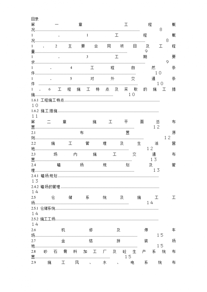
 Construction Organization Design of Civil Works of Dukouba Hydropower Station Dam Complex (formal) - Figure 1

Construction Organization Design of Civil Works of Dukouba Hydropower Station Dam Complex (formal) - Figure 1

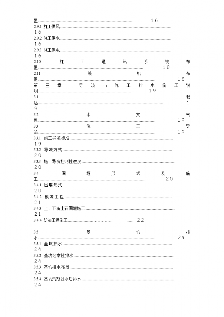
 Construction Organization Design of Civil Works of Dukouba Hydropower Station Dam Complex (formal) - Figure 2

Construction Organization Design of Civil Works of Dukouba Hydropower Station Dam Complex (formal) - Figure 2

 Construction Organization Design of Civil Works of Dukouba Hydropower Station Dam Complex (formal) - Figure 3

Construction Organization Design of Civil Works of Dukouba Hydropower Station Dam Complex (formal) - Figure 3

 Construction Organization Design of Civil Works of Dukouba Hydropower Station Dam Complex (formal) - Figure 4

Construction Organization Design of Civil Works of Dukouba Hydropower Station Dam Complex (formal) - Figure 4

 Construction Organization Design of Civil Works of Dukouba Hydropower Station Dam Complex (formal) - Figure 5

Construction Organization Design of Civil Works of Dukouba Hydropower Station Dam Complex (formal) - Figure 5

Click to download the source file now

Special statement: This material belongs to the sharing uploaded by users Downloaded content, only for learning, not for commercial use. If there is any copyright problem, please timely contact Station delete!

Collection
share

WeChat code scanning and sharing

Click to share

  • Dukouba Hydropower Station Dam Complex Civil works Construction organization design scheme
    This data is the construction organization design scheme for the civil works of the dam hub of Dukouba Hydropower Station, which is detailed and can be used for reference.
  • A dam pivot of Dukouba Hydropower Station Civil works Construction organization design scheme
    This document is the construction organization design scheme (formal) for the civil works of the dam hub of Dukouba Hydropower Station. The content is detailed and can be used for reference.
  • Dukouba Hydropower Station Dam Civil works construction plan
    Construction Scheme for Dam Civil Works of Dukouba Hydropower Station Construction Scheme for Dam Civil Works of Dukouba Hydropower Station
  • A dam of Dukouba Hydropower Station Civil works Construction organization design
    Dukouba Hydropower Station is a hybrid power station located in the upper reaches of Meixi River, Xinzheng Township, Fengjie County, Chongqing. It is the first level of cascade planning of Meixi River. The dam site area controls a drainage area of 765km2, with an average annual flow of 18.2m3/s. The power station is a Grade III medium-sized project mainly for power generation, with comprehensive benefits such as tourism and flood control.
  • A Dukouba hydropower station dam Civil works Construction organization design
    The total storage capacity of the reservoir is 98.54 million m3, and the effective storage capacity is 70.11 million m, which is an annual regulation reservoir.
  • Dukouba Hydropower Station Dam Civil works Construction organization design
    The construction organization design of the dam civil works of Dukouba Hydropower Station is detailed and rich, which can be downloaded by netizens. Dukouba Hydropower Station is a hybrid power station, which is located in the upper reaches of Meixi River, Xinzheng Township, Fengjie County, Chongqing The first level of cascade planning, the dam site area controls a drainage area of 765km2, and the average annual flow is 18.2m3/s. The power station is a It is a Grade III medium-sized project mainly for power generation and with comprehensive benefits such as tourism and flood control. The total storage capacity of the reservoir is 98.54 million m3, The effective storage capacity is 70.11 million m, which is an annual regulation reservoir.
  • Dukouba Hydropower Station Dam Complex Civil works Text of construction organization design scheme
    Dukouba Hydropower Station is a hybrid power station located in the upper reaches of Meixi River, Xinzheng Township, Fengjie County, Chongqing. It is the first level of cascade planning of Meixi River. The dam site area controls a drainage area of 765km2, with an average annual flow of 18.2m3/s. The power station is a Grade III medium-sized project mainly for power generation, with comprehensive benefits such as tourism and flood control. The total storage capacity of the reservoir is 98.54 million m3, and the effective storage capacity is 70.11 million m, which is an annual regulation reservoir. The dam site is located 7km upstream of Xinzheng Township, Fengjie County, 90km away from Fengjie County; The plant is located at the Dalangou of Pingping Town, 54km away from Fengjie County. The main structures of Dukouba Hydropower Station include water retaining (discharging) structures, water intake structures, diversion structures and power house, with a total installed capacity of 129MW (2 × 64.5MW). Concrete arch dam is a Grade 3 building. The foundation surface elevation is ▽ 470.00m, the dam crest elevation is ▽ 578.50m, and the maximum dam height is 108.5m. Parabolic variable thickness double curvature arch dam is adopted for its shape. The center angle of the crown is 98 °, the maximum half center angle is 46.76 °, and the minimum half center angle is 26.88 °. The maximum radius of curvature of the arch ring center line at the crown beam is 120.6m, the minimum radius of curvature is 53.4m, and the dam axis is 284.123m long. It is divided into 16 dam sections. The dam crest is 4.5m thick, the bottom is 20.0m thick, and the thickness height ratio is 0.18. Grouting gallery, traffic gallery, water collecting well, pumping pump and vent pipe are set inside the dam body, and grouting adit, drainage tunnel, traffic bridge, dam rear bridge and elevator shaft are set outside the dam
  • A dam pivot of Dukouba Hydropower Station Civil works Construction organization design scheme (formal)
    The external transportation conditions of the project are relatively convenient. The project area is 90km away from Fengjie County and 7km away from Xinzheng Township.
  • Chongqing Dukouba Hydropower Station Dam Complex Civil works Organize the design of construction scheme
    The dam of this project is an arch dam structure, which requires strict temperature control of concrete. In order to do a good job in temperature control of concrete, refrigeration equipment will be established in the concrete mixing system to produce qualified temperature controlled concrete products.
  • Dukouba Hydropower Station Dam Complex Civil works Construction organization design scheme (formal)
    Construction Organization Design Scheme for Civil Works of Dukouba Hydropower Station Dam Complex (formal) Construction Organization Design Scheme for Civil Works of Dukouba Hydropower Station Dam Complex (formal)
  • Dukouba Hydropower Station Dam Civil works Construction organization design document
    Dukouba Hydropower Station is a hybrid power station located in the upper reaches of Meixi River, Xinzheng Township, Fengjie County, Chongqing. It is the first level of cascade planning of Meixi River. The dam site area controls a drainage area of 765km2, with an average annual flow of 18.2m3/s. The power station is a Grade III medium-sized project mainly for power generation, with comprehensive benefits such as tourism and flood control. The total storage capacity of the reservoir is 98.54 million m3, and the effective storage capacity is 70.11 million m, which is an annual regulation reservoir. The dam site is located 7km upstream of Xinzheng Township, Fengjie County, 90km away from Fengjie County; The plant is located at the Dalangou of Pingping Town, 54km away from Fengjie County. The main structures of Dukouba Hydropower Station include water retaining (discharging) structures, water intake structures, diversion structures and power house, with a total installed capacity of 129MW (2 × 64.5MW). Concrete arch dam is a Grade 3 building. The foundation surface elevation is ▽ 470.00m, the dam crest elevation is ▽ 578.50m, and the maximum dam height is 108.5m. Parabolic variable thickness double curvature arch dam is adopted for its shape. The center angle of the crown is 98 °, the maximum half center angle is 46.76 °, and the minimum half center angle is 26.88 °. The maximum radius of curvature of the arch ring center line at the crown beam is 120.6m, the minimum radius of curvature is 53.4m, and the dam axis is 284.123m long. It is divided into 16 dam sections. The dam crest is 4.5m thick, the bottom is 20.0m thick, and the thickness height ratio is 0.18. Grouting gallery, traffic gallery, sump, pump and vent pipe are set inside the dam body, and grouting adit, drainage tunnel, traffic bridge, dam rear bridge and elevator shaft are set outside the dam. The flood discharge structure is located in the middle of the dam. The center line of the overflow weir coincides with the center line of the dam. It is composed of three overflow surface holes with the size of 12m × 12m (width × height). Each hole is equipped with an arc working gate for control, which is opened and closed by a hydraulic hoist. Weir body adopts WES type weir surface curve, and weir top elevation ▽ 563.00m. The front of weir crest adopts 1/4 elliptic curve, the rear of weir crest adopts curve equation, and the outlet adopts downflow. The maximum discharge is 3840m3/s, and the corresponding unit width flow is 116.4m3/s · m. As an energy dissipation structure, the plunge pool is a Grade 3 structure, including plunge pool, secondary dam and apron. The plunge pool is stepped, 165.53m long, 44m wide at the bottom, 79.44m wide at the top, and 469.0m at the lowest bottom elevation. At the end of the plunge pool, there are two dams with high backwater level. The axis is 66m long, 17.5m high, 2.7m wide at the top, 27.2m wide at the bottom, and ▽ 474.5m high at the bottom. There are drainage galleries and pumps in the dam. Behind the two dams, there is a 20m long apron and a toothed wall. The water intake adopts the tower type, which is divided into the upper structure and the lower structure. The substructure includes the water inlet passage, trash rack, trash rack breast wall and bulkhead gate shaft; The upper structure includes the water intake operation and maintenance platform, trash rack hoist chamber, hoist working bridge, bulkhead gate hoist chamber and traffic bridge. The elevation of water inlet bottom plate is ▽ 525.80m, and the elevation of maintenance platform is ▽ 578.50m. The headrace tunnel is arranged along the left bank, 600m long, round, 4.2m in diameter, and is lined with full section concrete. The cofferdam type is overflow cofferdam at the upstream and overflow cofferdam at the downstream. The upstream cofferdam shall be constructed by throwing and filling rubble revetment on the upstream face, reinforcing bar gabion slope pressing on the downstream face and anti-seepage with C20 concrete face slab. The downstream cofferdam is filled with earth and stone, and the structure of composite geomembrane seepage prevention is adopted. In order to meet the needs of mechanical construction, flood control and rescue, traffic and slag removal, the top width of upstream and downstream cofferdams is 8.0m. The upstream cofferdam is 14.4m high, the weir top elevation is ▽ 496.70m, and the axis length is 72.15m. The downstream cofferdam is 6.5m high, the weir top elevation is ▽ 486.80m, and the axis length is 31.3m. The diversion bottom outlet is constructed and blocked, and the diversion tunnel is blocked. The two diversion bottom outlets are arranged on the 8 # and 9 # dam monoliths. The elevation of the bottom outlets is 486.40m, and the size of the bottom outlets is 7m × 7m. The bottom outlets need to be plugged finally. The diversion tunnel is blocked with a gate for temporary water retaining, and the length of the plug is 36m. The construction diversion and water flow control works include river closure, drainage, construction of diversion bottom outlet, preparation of diversion bottom outlet and diversion tunnel plugging, flood control and other works, as well as other relevant temporary works. 1.2 Main contract items and quantities Main contract items include: concrete arch dam works, plunge pool works, water intake works, tunnel works. See the following table for main quantities. The construction period of Dukouba Junction Project is scheduled to start in the middle of July 2007, and the main works will be completed on June 1, 2010. Table 1-2 Main Control Duration
  • Dukouba Hydropower Station Dam Civil works Construction organization design
    There are many mountain coal caves and mined out areas on both sides of the dam in this project, which are difficult to handle and have an impact on the progress of the main works. Our department will excavate and clean the coal caves and mined out areas in combination with the requirements of the design documents and the actual situation on site, and then carry out backfill concrete and backfill grouting construction. The treatment of coal tunnel and goaf will be combined with the construction roads on both banks, and parallel operation will be carried out along different elevations to reduce the construction period. At the same time, during the excavation of dam abutment, the tunnel construction such as traffic and grouting will be left in the flood season for treatment, so as not to occupy the straight construction period.
  • Dukouba Hydropower Station Dam Civil works Construction organization design Word
    Dukouba Hydropower Station is a hybrid power station located in the upper reaches of Meixi River, Xinzheng Township, Fengjie County, Chongqing. It is the first level of cascade planning of Meixi River. The dam site area controls a drainage area of 765km2, with an average annual flow of 18.2m3/s. The power station is a Grade III medium-sized project mainly for power generation, with comprehensive benefits such as tourism and flood control. The total storage capacity of the reservoir is 98.54 million m3, and the effective storage capacity is 70.11 million m, which is an annual regulation reservoir.
  • Dukouba Hydropower Station Dam Complex Civil works Project Specification of Construction Organization Design Scheme
    The main works of construction diversion and flow control of the contract project include: construction and maintenance of upstream and downstream transverse cofferdams; Diversion tunnel, diversion bottom outlet and its inlet and outlet cofferdams; Safe flood prevention and protection works in dam site area; Foundation pit drainage of buildings; Cleaning and recovery of Phase II foundation pit after overflow; Demolition of diversion and water retaining structures; Gate lowering and blocking of diversion buildings.
  • Chongqing Dukouba Hydropower Station Dam Complex Civil works Construction organization design scheme
    The construction power supply load of the project is mainly composed of open excavation of earthwork, rock tunnel excavation, shotcrete anchor support, water supply and drainage, construction air supply, aggregate processing, concrete production and construction, grouting, metal structure manufacturing and installation, machine repair, comprehensive processing, construction lighting, domestic power and other items.
  • [Dukouba Hydropower Station Dam Civil works Construction organization design
    Dukouba Hydropower Station is a hybrid power station located in the upper reaches of Meixi River, Xinzheng Township, Fengjie County, Chongqing. It is the first level of cascade planning of Meixi River. The dam site area controls a drainage area of 765km2, with an average annual flow of 18.2m3/s. The power station is a Grade III medium-sized project mainly for power generation, with comprehensive benefits such as tourism and flood control. The total storage capacity of the reservoir is 98.54 million m3, and the effective storage capacity is 70.11 million m, which is an annual regulation reservoir.
  • Dukouba Hydropower Station Dam Complex Civil works Construction organization design proposal (formal)
    Dukouba Hydropower Station is a hybrid power station located in the upper reaches of Meixi River, Xinzheng Township, Fengjie County, Chongqing. It is the first level of cascade planning of Meixi River. The dam site area controls a drainage area of 765km2, with an average annual flow of 18.2m3/s. The power station is a Grade III medium-sized project mainly for power generation, with comprehensive benefits such as tourism and flood control. The total storage capacity of the reservoir is 98.54 million m3, and the effective storage capacity is 70.11 million m, which is an annual regulation reservoir. The dam site is located 7km upstream of Xinzheng Township, Fengjie County, 90km away from Fengjie County; The plant is located at the Dalangou of Pingping Town, 54km away from Fengjie County. The main works of construction diversion and flow control of the contract project include: construction and maintenance of upstream and downstream transverse cofferdams; Diversion tunnel, diversion bottom outlet and its inlet and outlet cofferdams; Safe flood prevention and protection works in dam site area; Foundation pit drainage of buildings; Cleaning and recovery of Phase II foundation pit after overflow; Demolition of diversion and water retaining structures; Gate lowering and blocking of diversion buildings.
  • Dam pivot of Dukouba Hydropower Station in Zhongyuan District, Zhengzhou Civil works Construction organization design scheme
    During the construction, the excavation quality will be guaranteed mainly from the following aspects: surveying and setting out, drilling accuracy, charge amount and charge structure, control blasting, slope protection, blasting monitoring, filling test, etc
  • Dam pivot of Dukouba Hydropower Station in a city Civil works Construction organization design scheme
    The external transportation conditions of the project are relatively convenient. The project area is 90km away from Fengjie County and 7km away from Xinzheng Township. Fengjie is 119 km upstream from the Yangtze River waterway to Wanxian, 326 km to Fuling, and 446 km to Chongqing; 35 km down to Wushan, 202 km to Yichang, and 2054 km to Shanghai. Water transport conditions are superior.
  • Dukouba Hydropower Station Dam Complex Civil Works/Project Construction Organization Design (formal)
    Dukouba Hydropower Station is a hybrid power station located in the upper reaches of Meixi River, Xinzheng Township, Fengjie County, Chongqing. It is the first level of cascade planning of Meixi River. The dam site area controls a drainage area of 765km2, with an average annual flow of 18.2m3/s. The power station is a Grade III medium-sized project mainly for power generation, with comprehensive benefits such as tourism and flood control. The total storage capacity of the reservoir is 98.54 million m3,
  • Hydropower dam Civil works Construction organization design
    Content introduction 5.6.4 Tunnel stonework excavation The tunnel excavation in this section adopts full face one-time blasting excavation construction. YT-28 rock drill is selected as drilling equipment. Detonating tube is used for blasting in sections, and smooth hole is detonated with detonating wire, and millisecond delay blasting is carried out from inside to outside in turn. Ventilation and smoke exhaust after blasting. Then, after the safety inspection and danger elimination of the working face, the mucking will be started. The mucking from tunnel rock excavation will be loaded by loader and transported by 10t dump truck. The construction procedure is as follows: drilling and blasting design - measuring and hole arrangement - drilling - acceptance, charging - hole plugging - networking, blasting - ventilation, smoke exhaust - danger elimination - slag removal - (support) - entering the next excavation cycle. (1) The tunnel excavation length of this section is 600m in the drilling and blasting design. From the geological data, for the tunnel excavation area crossing the gas, strengthen the gas detection, smoke exhaust and ventilation, and take safety precautions to ensure the safety of tunnel excavation construction. The blasting design of various surrounding rocks shall be completed before construction, and the blasting design parameters shall be modified in time according to the blasting effect during construction. Due to geological changes, when the tunnel passes through weak surrounding rocks or faults, the blasting method shall be adjusted in time, and the initial support shall be strengthened by using a steel lattice framework (φ 2mm). Vertical barrel cut is adopted for blasting excavation. The cut hole is 3.0m deep, and the blast hole is 2.5m deep. Smooth blasting is adopted around the hole, with hole depth of 2.5m and hole spacing of 0.5m. The preliminary blasting parameters are as follows: 1) The diameter of the cutting hole: Φ 45mm; Drilling depth: 3m; Spacing: 0.8m; Row spacing: 0.8m; Diameter of drug roll: Φ 32mm; Single hole charge: 1.6Kg/hole. 2) The borehole diameter of the caving hole is φ 45mm, the spacing between rows is 80cm, the drilling depth is 2.5m, the diameter of the cartridge roll is φ 32mm, and the single hole charge is 1.0kg/hole. 3) Drilling diameter of peripheral smooth blasting hole: Φ 45mm; Drilling depth: 2.5m; Spacing: 0.5m; Diameter of drug roll: Φ 25mm; Single hole charge: 0.75Kg/hole. The above blasting parameters for tunnel excavation shall be tested on site before formal excavation, and the optimal blasting parameters shall be selected and submitted to the supervisor for approval. At the same time, during the excavation process, experience shall be continuously summarized, and then suggestions for modification shall be put forward, which shall be implemented after being approved by the supervisor to make the blasting design more realistic. (2) In order to achieve a good blasting effect, the hole opening error of the blasthole shall not be greater than 3cm for the cut hole and the surrounding holes, the rest of the holes shall not be greater than 5cm, and the direction deviation of all blastholes shall not be greater than 3cm/m. TAPS tunnel laser polar coordinate section measuring instrument is used to accurately measure the centerline level. Use TAPS laser profiler to automatically arrange holes. (3) The YT-28 rock drill is used to drill holes for the excavation of the drilling tunnel. The cutting hole is 3.0m deep, the blasting hole is 2.5m deep, and the smooth blasting is used around the hole. The hole depth is 2.5m, and the hole spacing is 0.5m. Over drilling of 20cm is allowed. (4) After the acceptance and charging of YT-28 rock drill, the professional quality personnel shall check the hole depth, hole spacing, hole location and other hole making quality one by one, and the charging construction can be carried out only after the inspection is qualified. Emulsion explosives shall be used as blasting materials.
  • Dam hydroproject of hydropower station Civil works Construction organization design
    Concrete arch dam is a Grade 3 building. The foundation surface elevation is ▽ 470.00m, the dam crest elevation is ▽ 578.50m, and the maximum dam height is 108.5m. Parabolic variable thickness double curvature arch dam is adopted for its shape. The center angle of the crown is 98 °, the maximum half center angle is 46.76 °, and the minimum half center angle is 26.88 °. The maximum radius of curvature of the arch ring center line at the crown beam is 120.6m, the minimum radius of curvature is 53.4m, and the dam axis is 284.123m long. It is divided into 16 dam sections. The dam crest is 4.5m thick, the bottom is 20.0m thick, and the thickness height ratio is 0.18. Grouting gallery, traffic gallery, sump, pump and vent pipe are set inside the dam body, and grouting adit, drainage tunnel, traffic bridge, dam rear bridge and elevator shaft are set outside the dam.
  • Dukouba Hydropower Station Dam in a city Civil works Construction organization design
    As the construction site of this section is narrow and small, it is difficult to arrange temporary facilities. In order to facilitate construction, temporary buildings will be arranged in centralized areas. The living camp and processing plant are arranged at the downstream of the right bank, 2km away from the dam site in Zhongjiaping District. The gravel processing system and concrete mixing system are centrally arranged near the upstream dam site on the left bank. The mountain here is relatively gentle, and the amount of site leveling work is relatively small. The centralized layout is also convenient for management. Temporary construction projects such as explosive magazine, air compression station and water pool are scattered in corresponding areas according to construction needs.
  • Civil Construction Design Scheme of Dukouba Hydropower Station Dam Complex (formal)
    3) For curtain grouting, XY-2 geological drill equipped with hydraulic percussive rotary drilling tool is used, and diamond drill bit is used to make holes. KXP-1 inclinometer is used to conduct full hole tracking and deviation measurement, and correct deviation in time to ensure that the deviation value of hole deviation meets the design requirements; If the correction is invalid, the original hole shall be scrapped and re drilled as instructed by the Supervisor. 4) The core acquisition rate of curtain grouting reaches more than 90%, and the core shall be recorded as required and the results shall be submitted to the Supervisor.
  • Dukouba Hydropower Station Dam Civil works Construction organization design proposal
    Dukouba Hydropower Station is a hybrid power station located in the upper reaches of Meixi River, Xinzheng Township, Fengjie County, Chongqing. It is the first level of cascade planning of Meixi River. The dam site area controls a drainage area of 765km2, with an average annual flow of 18.2m3/s. The power station is a Grade III medium-sized project mainly for power generation, with comprehensive benefits such as tourism and flood control. The total storage capacity of the reservoir is 98.54 million m3, and the effective storage capacity is 70.11 million m, which is an annual regulation reservoir. The dam site is located 7km upstream of Xinzheng Township, Fengjie County, 90km away from Fengjie County; The plant is located at the Dalangou of Pingping Town, 54km away from Fengjie County. The main structures of Dukouba Hydropower Station include water retaining (discharging) structures, water intake structures, diversion structures and power house, with a total installed capacity of 129MW (2 × 64.5MW). Concrete arch dam is a Grade 3 building. The foundation surface elevation is ▽ 470.00m, the dam crest elevation is ▽ 578.50m, and the maximum dam height is 108.5m. Parabolic variable thickness double curvature arch dam is adopted for its shape. The center angle of the crown is 98 °, the maximum half center angle is 46.76 °, and the minimum half center angle is 26.88 °. The maximum radius of curvature of the arch ring center line at the crown beam is 120.6m, the minimum radius of curvature is 53.4m, and the dam axis is 284.123m long. It is divided into 16 dam sections. The dam crest is 4.5m thick, the bottom is 20.0m thick, and the thickness height ratio is 0.18. Grouting gallery, traffic gallery, sump, pump and vent pipe are set inside the dam body, and grouting adit, drainage tunnel, traffic bridge, dam rear bridge and elevator shaft are set outside the dam. The flood discharge structure is located in the middle of the dam. The center line of the overflow weir coincides with the center line of the dam. It is composed of three overflow surface holes with the size of 12m × 12m (width × height). Each hole is equipped with an arc working gate for control, which is opened and closed by a hydraulic hoist. Weir body adopts WES type weir surface curve, and weir top elevation ▽ 563.00m. The front of weir crest adopts 1/4 elliptic curve, the rear of weir crest adopts curve equation, and the outlet adopts downflow. The maximum discharge is 3840m3/s, and the corresponding unit width flow is 116.4m3/s · m. As an energy dissipation structure, the plunge pool is a Grade 3 structure, including plunge pool, secondary dam and apron. The plunge pool is stepped, 165.53m long, 44m wide at the bottom, 79.44m wide at the top, and 469.0m at the lowest bottom elevation. At the end of the plunge pool, there are two dams with high backwater level. The axis is 66m long, 17.5m high, 2.7m wide at the top, 27.2m wide at the bottom, and ▽ 474.5m high at the bottom. There are drainage galleries and pumps in the dam. Behind the two dams, there is a 20m long apron and a toothed wall.
  • Dam hydroproject of hydropower station Civil works Construction organization design
    XX Hydropower Station is a hybrid power station, located in the upstream reach of XX River in XX Township, XX County, XX City. It is the first level of cascade planning of XX River. The dam site area controls a drainage area of 765km2, with an average annual flow of 18.2m3/s. The power station is a Grade III medium-sized project mainly for power generation, with comprehensive benefits such as tourism and flood control. The total storage capacity of the reservoir is 98.54 million m3,
  • Dam hydroproject of hydropower station Civil works Construction organization design
    The hydropower station is a hybrid power station, which is located in the upstream reach of XX River in XX Township, XX County, XX City. It is the first level of cascade planning of XX River. The dam site area controls a drainage area of 765km2, with an average annual flow of 18.2m3/s. The power station is a Grade III medium-sized project mainly for power generation, with comprehensive benefits such as tourism and flood control. The total storage capacity of the reservoir is 98.54 million m3, and the effective storage capacity is 70.11 million m, which is an annual regulation reservoir. The dam site is located 7km upstream of XX Township, XX County, 90km away from XX County; The plant is located at XX Ditch, XX Town, 54km away from XX County.
  • Hydropower dam Civil works Construction organization design
    Concrete arch dam is a Grade 3 building. The foundation surface elevation is ▽ 470.00m, the dam crest elevation is ▽ 578.50m, and the maximum dam height is 108.5m. Parabolic variable thickness double curvature arch dam is adopted for its shape. The center angle of the crown is 98 °, the maximum half center angle is 46.76 °, and the minimum half center angle is 26.88 °. The maximum radius of curvature of the arch ring center line at the crown beam is 120.6m, the minimum radius of curvature is 53.4m, and the dam axis is 284.123m long. It is divided into 16 dam sections. The dam crest is 4.5m thick, the bottom is 20.0m thick, and the thickness height ratio is 0.18. Grouting gallery, traffic gallery, sump, pump and vent pipe are set inside the dam body, and grouting adit, drainage tunnel, traffic bridge, dam rear bridge and elevator shaft are set outside the dam.
  • A hydropower project in Gansu Civil works Tender Document
    The xxxx Tiecheng Hydropower Station Project is located in xx County, xx Province, downstream of xx, about 172km away from xx City. The right bank of the river section is the provincial highway 301 (Minmen Highway), which is very convenient for external transportation. Tiecheng Hydropower Station focuses on power generation and adopts a mixed development scheme. A diversion hub is built near the 62km of the xx301 highway to raise the xx water level to 2072.5m, and then the pressure tunnel is used to divert water to the Zhizhipai power house for power generation. The project belongs to Grade III medium-sized project. The main buildings are designed as Grade 3, and the secondary buildings and temporary buildings are Grade 5. The power station is composed of water diversion hub, pressurized water diversion system, power house, booster station and other buildings, with a total installed capacity of 51.5MW and an average annual power generation of 174 million kW. h.
  • Hydropower project Civil works Construction organization design
    The civil engineering bid section of the project is mainly composed of 2-hole intake gate, 1-hole sediment discharge gate, 3-hole sluice gate, energy dissipation structures behind the gate, connecting structures on the left and right banks, diversion culvert pipes, flood discharge aqueducts and other projects. The intake gate is arranged laterally, with an angle of 50 degrees to the river channel; The gate body is arranged in four sections, from front to back, it is successively the sand guide sill, the flat bottom broad crest weir, the transition section and the water inlet; The size of the water inlet orifice is 4 × 4m (width × height). A reinforced concrete breast wall is set in front of the water inlet, followed by the culvert section of the diversion and power tunnel. The desilting gate is located at the downstream of the intake gate sand guide sill, and is arranged in a positive direction along the left bank of the river channel. It is provided with one hole. The total length of the gate body is 24m, the total width is 7m, and the size of the hole is 3 × 3m (width × height). The sluice gate is adjacent to the sand sluicing gate and arranged in the mainstream area of the river. The gate centerline is parallel to the river centerline; The gate body has a total length of 24m and a total width of 35.5m. There are three holes in total, and the hole size is 8.5 × 9m (width × height). The bulkhead gate warehouse is set at the right side of the sluice gate, which is of reinforced concrete box structure. The energy dissipation behind the gate adopts underflow energy dissipation, which is composed of stilling pool, apron, anti scour apron and other structures; The stilling pool is 23m long, 37.5m wide and 1.4m deep. Gravity concrete side walls are set on both sides of the pool; Behind the stilling pool is a reinforced concrete apron, 25m long, 37.5m wide and 50cm thick, with gravity concrete side walls on both sides; The apron is followed by a block stone anti scour apron with a total length of 15m, a net width of 37.5m and a thickness of 50cm.
  • A hydropower project in Gansu Civil works Tender Document
    The xxxx Tiecheng Hydropower Station Project is located in xx County, xx Province, downstream of xx, about 172km away from xx City. The right bank of the river section is the provincial highway 301 (Minmen Highway), which is very convenient for external transportation. Tiecheng Hydropower Station focuses on power generation and adopts a mixed development scheme. A diversion hub is built near the 62km of the xx301 highway to raise the xx water level to 2072.5m, and then the pressure tunnel is used to divert water to the Zhizhipai power house for power generation. The project belongs to Grade III medium-sized project. The main buildings are designed as Grade 3, and the secondary buildings and temporary buildings are Grade 5. The power station is composed of water diversion hub, pressurized water diversion system, power house, booster station and other buildings, with a total installed capacity of 51.5MW and an average annual power generation of 174 million kW. h.
  • Hydropower dam Civil works Construction organization design
    Xx Hydropower Station is a hybrid power station, located in the upper reaches of xx River in xx Township, xx County, xx City, which is the first level of cascade planning of xx River. The dam site area controls a drainage area of 765km2, with an average annual flow of 18.2m3/s. The power station is a Grade III medium-sized project mainly for power generation, with comprehensive benefits such as tourism and flood control. The total storage capacity of the reservoir is 98.54 million m3, and the effective storage capacity is 70.11 million m, which is an annual regulation reservoir. The dam site is located 7km upstream of xx Township, xx County, 90km away from xx County; The plant site is located at the Dalangou of Pingping Town, 54km away from xx County. The main structures of xx hydropower station project include water retaining (discharging) structures, water intake structures, diversion structures and power house. The total installed capacity of the power station is 129MW (2 × 64.5MW). Concrete arch dam is a Grade 3 building. The foundation surface elevation is ▽ 470.00m, the dam crest elevation is ▽ 578.50m, and the maximum dam height is 108.5m. Parabolic variable thickness double curvature arch dam is adopted for its shape. The center angle of the crown is 98 °, the maximum half center angle is 46.76 °, and the minimum half center angle is 26.88 °. The maximum radius of curvature of the arch ring center line at the crown beam is 120.6m, the minimum radius of curvature is 53.4m, and the dam axis is 284.123m long. It is divided into 16 dam sections. The dam crest is 4.5m thick, the bottom is 20.0m thick, and the thickness height ratio is 0.18. Grouting gallery, traffic gallery, sump, pump and vent pipe are set inside the dam body, and grouting adit, drainage tunnel, traffic bridge, dam rear bridge and elevator shaft are set outside the dam. The flood discharge structure is located in the middle of the dam. The center line of the overflow weir coincides with the center line of the dam. It is composed of three overflow surface holes with the size of 12m × 12m (width × height). Each hole is equipped with an arc working gate for control, which is opened and closed by a hydraulic hoist. Weir body adopts WES type weir surface curve, and weir top elevation ▽ 563.00m. The front of weir crest adopts 1/4 elliptic curve, the rear of weir crest adopts curve equation, and the outlet adopts downflow. The maximum discharge is 3840m3/s, and the corresponding unit width flow is 116.4m3/s · m. As an energy dissipation structure, the plunge pool is a Grade 3 structure, including plunge pool, secondary dam and apron. The plunge pool is stepped, 165.53m long, 44m wide at the bottom, 79.44m wide at the top, and 469.0m at the lowest bottom elevation. At the end of the plunge pool, there are two dams with high backwater level. The axis is 66m long, 17.5m high, 2.7m wide at the top, 27.2m wide at the bottom, and ▽ 474.5m high at the bottom. There are drainage galleries and pumps in the dam. Behind the two dams, there is a 20m long apron and a toothed wall. The water intake adopts the tower type, which is divided into the upper structure and the lower structure. The substructure includes the water inlet passage, trash rack, trash rack breast wall and bulkhead gate shaft; The upper structure includes the water intake operation and maintenance platform, trash rack hoist chamber, hoist working bridge, bulkhead gate hoist chamber and traffic bridge. The elevation of water inlet bottom plate is ▽ 525.80m, and the elevation of maintenance platform is ▽ 578.50m. The headrace tunnel is arranged along the left bank, 600m long, round, 4.2m in diameter, and is lined with full section concrete. The cofferdam type is overflow cofferdam at the upstream and overflow cofferdam at the downstream. The upstream cofferdam shall be constructed by throwing and filling rubble revetment on the upstream face, reinforcing bar gabion slope pressing on the downstream face and anti-seepage with C20 concrete face slab. The downstream cofferdam is filled with earth and stone, and the structure of composite geomembrane seepage prevention is adopted. In order to meet the needs of mechanical construction, flood control and rescue, traffic and slag removal, the top width of upstream and downstream cofferdams is 8.0m. The upstream cofferdam is 14.4m high, the weir top elevation is ▽ 496.70m, and the axis length is 72.15m. The downstream cofferdam is 6.5m high, the weir top elevation is ▽ 486.80m, and the axis length is 31.3m. The diversion bottom outlet is constructed and blocked, and the diversion tunnel is blocked. The two diversion bottom outlets are arranged on the 8 # and 9 # dam monoliths. The elevation of the bottom outlets is 486.40m, and the size of the bottom outlets is 7m × 7m. The bottom outlets need to be plugged finally. The diversion tunnel is blocked with a gate for temporary water retaining, and the length of the plug is 36m. The construction diversion and water flow control works include river closure, drainage, construction of diversion bottom outlet, preparation of diversion bottom outlet and diversion tunnel plugging, flood control and other works, as well as other relevant temporary works.
  • Dam of a hydropower station Civil works Roller compacted concrete construction method
    This data is the construction method of roller compacted concrete for the dam civil engineering of a hydropower station, and its contents are for reference only
  • Hydropower project Civil works Construction organization design
    Xxxx Hydropower Station is located on the xx main stream in xxxx County, which is the upper cascade power station of the proposed xxxx Hydropower Station. There is a special railway line from xx to xx Mountain Mine along the river bank in the project area. The hub is located at the downstream side of xx Station on the special railway line from xx to xx Mountain Mine, about 73km north of xx City; The plant site is located about 3.6km upstream of xx station on xx special railway line, with a design water head of about 189m and a total installed capacity of 52.8MW (3 × 17.6 MW). It belongs to Class III medium-sized project. The main buildings are Level 3 buildings, the secondary buildings are Level 4 buildings, and the temporary buildings are Level 5 buildings. The power station is composed of hydroproject, diversion and power generation tunnel, surge shaft, penstock, ground powerhouse and other buildings.
  • Hydropower dam Civil works Technical scheme of construction survey
    This data is the technical scheme for construction survey of dam civil works of hydropower station, 17 pages in total. Introduction: The project is of Grade II, and the scale of the project is large (2) type. The main buildings such as water retaining structures, water release structures and power plant buildings are of Grade II, and the structural safety level of corresponding hydraulic structures is of Grade II; Secondary buildings are Grade 3 buildings, and the structural safety level of corresponding hydraulic structures is Grade II. The main works of the contract include: ① water retaining and release structure works (non overflow dam sections on the left and right banks, flood gate dam sections); ② Power house works; ③ Gate slot embedded parts, grounding and other electrical embedded parts works (flood gate service gate and emergency gate); ④ Trash detention and floating works in the reservoir area; ⑤ Access road works.
  • A hydropower project in Gansu Civil works Tender Document
    The hydroproject is mainly composed of the roller compacted concrete gravity dam and the power station intake on the right bank of the dam upstream. The normal pool level and design flood level are 2072.5m, the check flood level is 2073.7m, and the dam crest elevation is 2075.3m. The overburden layer of the dam foundation is 4~10m deep, almost without strong weathered layer, and the weak weathered layer is 2~3m deep. The rock is granite gneiss, and the foundation conditions are good; According to the requirements of the specification and in order to save investment, the dam foundation is built on the line of the weakly differentiated layer. The foundation elevation is 2031.00m, the maximum dam height is 44.3m, and the dam crest is 138.5m long. A middle hole for flood discharge and sediment discharge is set in the dam section on the right side of the dam body, and a radial service gate is set at the outlet. The orifice size is 6 × 6m (width × height), which is controlled by a hydraulic hoist. Three flood discharge surface outlets are set directly opposite the dam section of the main river bed, with the orifice size of 10 × 10m (width × height), radial service gate and hydraulic hoist control; The bulkhead gate is set at the upstream of the middle hole and surface hole, sharing the control of the gantry crane. The energy dissipation mode of dam flood discharge is flip flow energy dissipation. Next to the middle hole is the water intake of the power generation diversion tunnel. The bottom plate of the water intake is 2058m high. Two trash racks are arranged. The size of the orifice is 5 × 12.5m (W × H). Mechanical cleaning is used. An emergency bulkhead gate is set behind the trash rack. The size of the orifice is 6 × 6m (W × H). High lift winch is used for hoisting; The pressure diversion tunnel is connected to the water inlet of the power station and passes through the mountain on the right bank to reach the surge shaft; The tunnel is 2.734km long and 6m in diameter. After the surge shaft is the pressure pipe, 193m long, which is in the form of one pipe with multiple units. The power house of the power station is located on the xx right bank terrace at the downstream of the selected site, Zhifangpai Village. Three large and one small vertical units are arranged in the main power house; The auxiliary power house is located at the upstream side of the main power house. Two main transformers are arranged behind the upstream wall of the auxiliary power house. The river beach on the right side of the tailrace is filled with spoil to the same height as the plant area. The booster station and permanent management house are arranged. The plant access road is arranged on the right side of the power house, which is open to 301 highway.
Click to see more
All comments I want to comment
No comment