Uploaded on: 2019-12-05 18:24:55 come from: water conservancy project / water conservancy project / Hydro junction
zero
5 points

The dredging, expansion and protection of xx Dachi, the construction of A and B connecting canals, and the reclamation and land reclamation project of xx Bay Education Island (excluding soft foundation treatment) are located in xx Bay, Xiamen City. Located in the landscape planning land of xx University Town, xx University of Technology and Xiamen University are respectively located on the east and west sides of xx Bay Reservoir. In combination with the planning and construction of Xiamen xx University Town, as a supporting facility, a recreational and tourist waterfront road will be built for xx University Town to improve the external environmental conditions of the plot and enhance the use value of the plot. At the same time, Xiamen will host the sixth International Garden Expo in 2007. The venue will be selected in the xx Bay (i.e. Zhongzhou Island and Xiamen South Block in the xx Bay). According to the "Garden Expo" plan, ten islands will be formed, including the Garden Island, the Art Island, the Flower Island, the Fruit Island, the Spring Island, and the Education Island, and the main islands will be connected by roads and bridges. This dredging and reclamation project is mainly to meet the requirements of xx pond expansion and slope reinforcement.

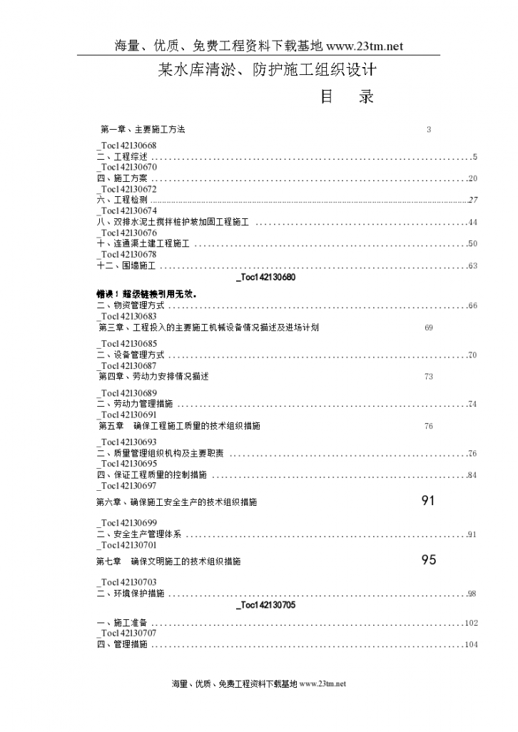
 Organization design for dredging and protection construction of a reservoir - Figure 1

Organization design for dredging and protection construction of a reservoir - Figure 1

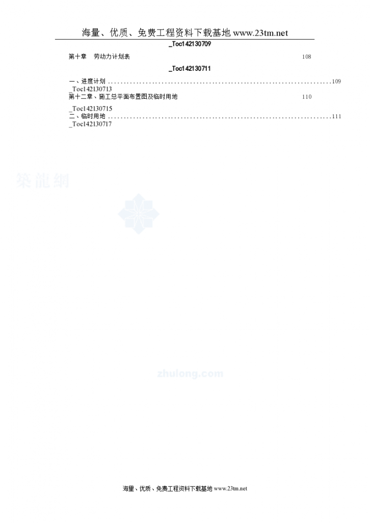
 Organization design for dredging and protection construction of a reservoir - Figure 2

Organization design for dredging and protection construction of a reservoir - Figure 2

 Organization design for dredging and protection construction of a reservoir - Figure 3

Organization design for dredging and protection construction of a reservoir - Figure 3

 Organization design for dredging and protection construction of a reservoir - Figure 4

Organization design for dredging and protection construction of a reservoir - Figure 4

 Organization design for dredging and protection construction of a reservoir - Figure 5

Organization design for dredging and protection construction of a reservoir - Figure 5

Click to download the source file now

Special statement: This material belongs to the sharing uploaded by users Downloaded content, only for learning, not for commercial use. If there is any copyright problem, please timely contact Station delete!

Collection
share

WeChat code scanning and sharing

Click to share

  • River dredging construction organization Design (Bid)
    This project is the dredging project of the river channel in the sand area section of the comprehensive treatment of water environment in the XX basin of Chongqing City (Section VII). The construction scope is K27+250 ~ K29+000, K33+300 ~ K43+500, with a total length of 11.95 km. The average dredging width of river channel K27+250 ~ K29+000 is designed as 32m; The average dredging width of K33+300 ~ K43+500 is designed as 35m; The main construction content is: 103300m3 of silt is excavated and discarded.
  • Construction organization of river sewage interception and desilting Design
    Jindi River is a tributary on the left bank of the lower reaches of the Yellow River. It is a plain river course, bordering the main stream of the Yellow River in the south and Weihe River, Tuhai River and Majia River in the north. It originates in Xinxiang County, Henan Province, flows through five cities and 12 counties in Henan Province, including Xinxiang, Hebi, Anyang, Puyang and Liaocheng in Shandong Province, and enters the Yellow River in Zhangzhuang, Taiqian County, Henan Province, with a drainage area of 5047km?.
  • Construction organization of river channel flood control and desilting control Design
    This data is the construction organization design of river channel flood control and desilting treatment, totaling 69 pages. Introduction: Newly built river embankment, gabion gabion gabions on the embankment body, the distance between the embankments is 6.0~10.Om, the height of the embankment is 2.4~2.8m, the width of the top of the embankment is 1.0n, the top of the embankment is paved with 10cm thick C20 concrete pressure, the upstream face of the embankment is stepped with a comprehensive slope ratio of 1:0.5, the back face is vertical, the bottom plate is excavated to the design elevation, and then compacted with excavated materials. After the excavation on the downstream side of the embankment, the clay is backfilled to the top of the embankment, and the top clay is backfilled with a width of 0.6m, The backfill slope ratio is 1:1.5; The stake number of urban section 1+500~2+300 adopts local repair of the existing masonry embankment and the construction of wave wall above, and the dredging treatment is adopted for the urban river channel.
  • Dredging construction organization of main stream of river Design (Word)
    This document is the organization design of dredging construction in the main stream of the river, 42 pages in total. Introduction: Most of the tributaries of the river have high sediment concentration due to backwater, resulting in serious siltation at the mouth of the tributaries on the main stream of the river and serious lack of flow capacity, which requires desilting. The total dredging length is 1900 meters, and the earthwork is 206816 cubic meters. Based on the principle of completing the construction task of the contract project on schedule in a safe, high-quality and efficient manner, establish a construction scheme demonstration system, and conduct construction tests before construction to optimize resource allocation parameters; Construction process parameters; Construction quality control standards; Formulate construction technical regulations.
  • Construction organization of slope protection and improvement Design
    Construction organization design of slope protection and renovation Construction organization design of slope protection and renovation Construction organization design of slope protection and renovation
  • Dredging construction organization of Jindi River Design .
    Bid C7: the upstream of Liutun barrage and the mouth of Gutou gully, with a total dredging length of 1900 meters (700 meters upstream of Liutun barrage and 1200 meters at the mouth of Gutou gully), and 206816 cubic meters of earthwork. Bid C8: The total desilting length of Huzhou gully mouth, Donglou gully mouth and Wuxing gully mouth is 2250 meters (Huzhou gully mouth 750 meters, Donglou gully mouth 750 meters, Wuxing gully mouth 750 meters), and the earthwork is 242525 cubic meters. Bid C9: 3000 meters downstream of Nanguan Bridge in Puyang County, 415085 cubic meters of earthwork.
  • Construction organization of river dredging and reconstruction project Design
    The construction site of the grain production base construction project in xx irrigation district of xx city is in xx city. Xx irrigation area is located 20km to the south of xx city and runs through five towns and townships of xx, xx, xx, xx, xx. The main contents of the project include: channel desilting, channel masonry, channel seepage prevention, channel closure and sewage channel works of the channel project at stake number 7+275~15+800; Hongshixia aqueduct maintenance, Hongshixia irrigation pumping station maintenance, Yunyangong irrigation pumping station project, control gate, exit gate, irrigation reservoir gate project, water diversion outlet, bridge, flood discharge channel project, etc. of canal system building project; Hongshixia Management Office and xx Management Office for management facilities; Temporary works, etc. 2.2 Governance standard and main contents of the project According to the requirements of the bidding documents, the governance standard of the project is that the quality of the project after completion should meet the design requirements. The main contents of this project are: ⑴. Channel project with stake number of 7+275~15+800; ⑵ Canal system building works; ⑶ Management facilities engineering; ⑷ Temporary works.
  • River dredging treatment and bridge construction organization Design
    XX is located at the junction of XX County and the southern urban area of XX City, between XX River and XX River. It starts from the north of West XX Village, crosses three highways, XX, XX, and flows eastward to XX Yangshuiji Station and joins XX River. With a drainage area of 195km2 and a total length of 28km, XX River is a major tributary of XX River. As the only drainage channel in the south of XX urban area, the river bears the functions of flood prevention and disaster reduction in XX County, Great Wall Motor Group, XX South Street, Lianchi South Street and other regions; At the same time, it receives cooling water from XX County Sewage Treatment Plant and Datang XX Thermal Power Plant. The new XX was excavated in 1965. Since it has not experienced flood and drainage for many years, it has been in disrepair for a long time. Illegal soil borrowing is serious along the riverway above Beidaran Village in XX County. Large pits have been formed in some parts of the original riverway, with a depth of 15 to 6 meters; Some enterprises fill rivers and build factories, and sand and stone materials, construction waste and domestic waste are piled up like mountains; The river crossing roads along the road are filled randomly, and no culvert pipe is buried, blocking the river channel. At present, there is basically no obvious river shape in this section of river, and the drainage capacity is lost. The river channel in the North Dalan Village section (within 1.0km upstream and downstream of XX highway bridge) has been renovated by XX County. The river bed from the downstream of Beida Ran Village to the XX River Estuary is high, with a small drop, and the width of the river is different. Dredging is urgently needed. Rubbishes on both sides of the river are stacked randomly, and tombs are scattered along the river; The bridge has serious water blocking, small flow capacity, and most of them are dangerous bridges, which are in urgent need of reconstruction. The project recovers the function of flood discharge and asphalt discharge by taking engineering measures such as dredging the river channel, cutting the beach and reconstructing water blocking structures. Clean and transport the garbage along the river, build some roads to connect with the existing roads, improve management and care facilities, strengthen river management, and achieve the goal of improving the ecology along the river.
  • Construction organization of river dredging works Design
    The construction site of this dredging project is xxxx section in xx city. The dredging scope is 6910 meters long from xxxx entrance to xx section, which is divided into four sections according to the project requirements: (1) 2600 meters long from xx entrance to new xx bridge; (2) 1200 meters from the new xx bridge to the personnel director; (3) 2100 meters from personnel bureau to xx; (4) The length from xx to railway bridge is 1010 meters. The river reach in the project area is winding and the water flow is relatively gentle. The average thickness of desilting is 2m, the average width of the river channel is 45m, and the average width of the silt in the river channel is 5m. The planned duration is 150 calendar days.
  • Construction organization of river dredging in a city Design
    Content introduction 6.1. Project overview 6.1.1 Comprehensive overview Project name: main road drainage pipe and channel desilting service project in ×× City Project location: contract mode in ×× City: lump sum contract for labor, material, quality, safety, tax, etc. 6.1.2. Project characteristics 1. The project is the main trunk road of the place, with many enterprises and intersections along the road, The scope of construction impact is large, such as road traffic, surrounding environment, nearby enterprises, along the road, street residents, etc., and the requirements for civilized construction are high. 2. Due to the large amount of engineering work, the construction task should be completed within the contract period, and a considerable amount of manpower, materials, funds, machinery and technology should be invested in a short time. 3. The project has a large working face and a long route, which brings inconvenience to the deployment and management of construction equipment. According to the actual situation of the site, the construction should be closely coordinated with road traffic operations, with strong management and many coordination departments. 4. The construction period of the project is tight, so the construction will be carried out by sections and zones, and the construction task will be completed as soon as possible to restore traffic. The total construction period will be controlled within the contract period.
  • [Jiangsu] Port road dredging construction organization Design
    Content introduction The current channel of the project has a water surface width of about 240m, a narrow deep groove, and most of the bank slopes are in natural state except for the town section, with serious slope collapse The project plans to use grab boat for loading, which will be transported to the designated temporary wharf by the dredger, and then filled by the dredger to the cofferdam in the spoil area or transported by cutter suction dredger for construction. The specific construction sequence is as follows: 1. Build cofferdams, water drainage facilities, clean the spoil ground, and erect mud blowing pipes; 2. From the excavation site, the grab boat is used to transport the mud to the dredger; 3. The dredger passes the existing channel to the vicinity of the dredger 3.2.1.1 Outlet gate The purpose of the outlet gate is to drain the residual water less than 2% of the mud concentration in the reclamation area to the outside of the reclamation area 10.5 Construction guarantee in typhoon period 1. Establish a leading group for typhoon prevention, establish and improve the safety measures for typhoon prevention, and ensure that the construction management personnel can avoid the typhoon safely. 2. The construction shall be organized in strict accordance with the design and planned procedures, and typhoon protection measures shall be arranged for the completed buildings to minimize the impact of typhoon damage. 3. After the typhoon, quickly inspect the buildings and take effective measures to repair the damaged parts in time; Organize construction machinery to resume production as soon as possible to minimize the impact of typhoon
  • Dredging construction organization of the whole river Design
    Main contents: 1. Dredging the moat. In the first phase, the moat of the office building around the city is dredged mechanically, and the landscape river of the office building in the east of the second phase is dredged manually with small machinery; 2. The moat is impervious. Composite geomembrane is used to pave the channel bottom; 3. Replacement of rainwater and sewage pipes around the moat. The sewage pipes of two ring moats and rainwater pipes of three ring moats were replaced. 4. Green plant restoration and protection.
  • [Hubei] Construction organization for dredging and expanding excavation of dam reach Design
    The main embankment in the south starts from XX, 210 meters above sea level, and is 7500 meters long, reaching the XX gate; The main dike in the north is 3000 meters long, and the branch dike of Jiabanxi is more than 2000 meters long. The whole dike is 12500 meters long. The average width of the dam foundation is 3m, the average width of the dam crest is 1.2m, and the average height of the dam is 4.5m. The average width of river bed of XX dam embankment is 80m.
  • River dredging construction organization Design (Bank slope pipeline)
    The project is classified as Grade III, and the river channel is a Grade III building. The main engineering projects include: river excavation, masonry retaining wall, hydrophilic platform, bank slope drainage pipe, pedestrian steps, pipeline foundation, etc. The design standard of this project is to store and discharge the maximum 1-hour rainstorm with a 5-year return period, and the maximum 24-hour rainstorm with a 20-year return period in the planned new town area. The flood control standard is the flood with a 20-year return period. The design maximum flow is 56m3/s, the design normal water level of the river is 1.5m, and the width of the normal water level river is about 16m (except for the section 0+000~0+090).
  • Anhui Sluice Construction and Dredging Organization Design
    Content Introduction Chapter VI Construction Diversion, Drainage and Flood Control Measures I Construction Diversion 1 Construction diversion overview The construction cofferdam of the building is level 4, and the diversion design flood standard is once every 10 years. The project is scheduled to be constructed in dry season, and the construction period is from October to November. The design flood levels of the cofferdam are 21.7m and 20.4m respectively. 2. Construction diversion mode of buildings The construction of old gate cofferdam starts filling when the water level at xx side drops to 18.0M; During the construction period, the lock water conveyance tunnel is used for full time diversion; When the water level reaches 20.0M, the cofferdam of the old gate section will be broken for overflow. 3. Cofferdam design Because the water level of the Huaihe River side in the dry season is 21.7M, the design elevation of the cofferdam is 22.5M, and the top width is 5m. The design slope of the expanded gate section is 1:3, the slope of the part below the elevation of 18.5M of the upstream surface of the cofferdam of the reinforced gate section is 1:6, and the slope of the part below the elevation of 18.5M of the downstream surface of the cofferdam of the reinforced gate section is 1:5. The bulldozer shall be used to compact the cofferdam 0.8m above the water surface. The dry weight after compaction from 0.8m above the water surface to the design elevation shall not be less than 15.5Kn/m3, and the compactness shall not be less than 92%. See the cofferdam design drawing for details. Since only the ship lock is used for diversion during the construction period, if the water level at xx side exceeds the submerged water level by 20.0 meters, the cofferdam at the old lock section will be removed to overflow, so as to prevent the water level at xx side of the upstream from being too high and flooding farmland and causing losses. The sub cofferdams shall be filled between the upstream and downstream diversion islands and cofferdams. The design elevation and top width of the sub cofferdams are the same as those of the downstream cofferdams, so as to prevent water from flowing into the foundation pit of the expansion gate from between the diversion island and the main cofferdam when the foundation pit of the old gate section overflows. 3.3.3 The design volume of river dredging for the cofferdam Xx reinforcement and expansion project in the scouring and filling area is 117344m3 in total, including 85357m3. Due to the reduction of land acquisition scope, when the cofferdam top elevation of the scouring and filling area is designed to be 23.5m, the area of the scouring and filling area is 14166 m2, the scouring and filling depth is 5 m, and the scouring and filling can be about 70830 m3. In addition, in combination with the excavation of the borrow pit, a cofferdam will be filled along the excavation area as the dredging and filling area at xx side. The total length of the cofferdam is about 500 meters. The elevation of the cofferdam top is designed as 22.5 m. The area of the scouring and filling area is about 14615 m2, the scouring and filling depth is 5 m, and the scouring and filling capacity is about 73075 m3. It can meet the dredging requirements. The design top width of the cofferdam in the scouring and filling area is 3.0 m, and the design top width of the cofferdam in the scouring and filling area with traffic requirements is 7.0 m. The transverse cofferdam is 120m long and the longitudinal cofferdam is 150m long. The construction of the cofferdam in the scouring and filling area is carried out in two phases. In the first phase, the main dam and the borrow area are used to fill the transverse cofferdam in the scouring and filling area. In the second phase, the foundation pit cofferdam is used to remove soil materials to fill the longitudinal cofferdam. The bulldozer is used to compact the cofferdam 0.8m above the water surface. The dry weight after compaction from 0.8m above the water surface to the design elevation is generally not less than 15.5Kn/m3, At the same time, the degree of compaction shall not be less than 92%. The design top width of the cofferdam in the scouring and filling area on the side of the Huaihe River is 3.0 m, the top elevation is 22.5 m, and the side slope is 1:2. During the clearing of the borrow pit, the earth from the borrow pit is directly used, and the excavator is used to cooperate with the bulldozer for filling construction. See the cofferdam design drawing for details. 2、 Construction dewatering and drainage The contents of construction dewatering and drainage mainly include regular drainage in the foundation pit, deep dewatering in the foundation pit and drainage in the soil pit drainage ditch. During the investigation of the preliminarily selected gate site, the stable groundwater level measured is 21.40~21.90m, and the stable groundwater level measured at the recommended gate site is 21.20~21.90m. ①, ② The permeability coefficient of layer 2 is k=7.59 × 10⁻⁵ ~ 1.02 × 10⁻⁶cm/s, the average permeability coefficient of layer ③ is k=5.82 × 10⁻⁶cm/s, the average permeability coefficient of layer ④ is k=4.72 × 10⁻⁵cm/s, and the permeability coefficient of layers ② 1 and ⑤ is k=i × 10-3cm/s ~ i × 10-4cm/s. The sluice site area has abundant groundwater sources, and the ⑤ fine sand layer has strong permeability, and the water level of the confined aquifer is high, which has a significant impact on the construction. It is planned to take measures to reduce groundwater to ensure construction. 1. Regular drainage Regular drainage includes foundation pit seepage, rainwater, construction waste water, etc. Foundation pit seepage and construction waste water can be ignored, so the number of pumps equipped mainly considers the drainage of rain and snow water. 1.1 Catchment area The foundation pit catchment area of the expansion gate of the project is large, and the catchment area of the foundation pit is about 39600m2. 1.2 The rainfall of 50mm/d is taken as the basis for setting drainage system. 1.3 Calculation of water volume to be discharged every day 39600 × 50/1000=1980m3 1.4 When excavating the foundation pit for water collection and drainage, dig out and riprap the anti scour groove first, and leave a pumping pit in the anti scour groove. During the construction, the drainage ditch shall be excavated according to the actual situation of the site to make the rainwater flow to the anti scour groove, so as to keep the foundation pit free of water as far as possible. The water pump shall be installed to timely drain the water in the temporary sump to the drainage area outside the cofferdam. For specific drainage ditch layout, please refer to "Layout Plan of Foundation Pit Dewatering and Drainage of Expansion Sluice" and "Layout Plan of Foundation Pit Dewatering and Drainage of Old Sluice". 1.5 The drainage equipment shall be equipped according to the principle that the maximum daily water collection during the regular drainage shall be discharged on the same day. The drainage equipment is equipped with submersible pump with power of 4.5KW, lift of 20m, flow of 45m3/h and model of QY20-45-4.5. The number of pumps required is: n=1980/(24 × 45)=1.8, taking n=2; Considering extreme factors, 4 pumps are actually arranged, 2 of which are standby pumps. Regular drainage has been in operation since November 2004 to May 2005, lasting about 7 months. 2. Deep foundation pit dewatering 2.1 Design basis: Technical Code for Building and Municipal Dewatering Engineering JGJ/T111-98; Technical Specification for Building Foundation Pit Support (JGJ120-99); 2.2 The selection of dewatering technology and method is planned to adopt the method of sand free tube well drainage for dewatering. Sand free tube wells are easy to arrange, can be put in place at one time, and do not need to arrange wells repeatedly, and the drainage pipeline has little impact on the construction roads in the site. 2.3 Layout of dewatering wells 8 sand free tube wells are arranged for the old sluice, and 12 sand free tube wells are arranged for the expansion sluice. See the "Layout Plan of Dewatering and Drainage of Foundation Pit of Expansion Sluice" and "Layout Plan of Dewatering and Drainage of Foundation Pit of Old Sluice" for the specific layout of dewatering wells. 2.4 For the structural design of the dewatering well, the well pipe shall be sand free filter pipe, and the solid pipe shall be used above the aquifer (fine sand layer). The outer diameter of the pipe shall be 500mm, the inner diameter of the pipe shall be 400mm, the length of the filter pipe shall be about 5m, the porosity shall not be less than 20%, and it shall be wrapped with two layers of 80 mesh nylon mesh. The dewatering well is drilled into the clay layer at the bottom of the permeable sand layer, 1m deep into the clay layer, and the bottom of the well is equipped with special bottom pipe.
  • Construction organization of river dredging works Design
    Content introduction ⑥ Protection of survey control pile The construction survey personnel numbered the main survey signs uniformly, drew them on the general construction plan, and noted the distance, angle relationship and elevation between each other to avoid errors. In order to prevent the displacement of survey signs during the construction period, each main survey sign shall be provided with a protective pile, which shall be regularly tested. ⑦ The layout of the construction survey control network The construction plane control survey is carried out with the total station. The construction control survey with total station is not only simple and fast, but also can improve the measurement accuracy and reduce errors. At the same time, it can also contact with the microcomputer for office calculation and data storage and sorting. The vertical control network shall be surveyed with precision level and second order leveling. Accuracy and technical requirements of construction control survey: the accuracy and technical requirements of construction control survey shall strictly comply with the provisions of GB50026-9 "Code for Engineering Survey".
  • Construction organization of pond desilting and backfilling works Design
    The quality and progress of dredging and backfilling construction of river ponds directly affect the quality and progress of subgrade earthwork filling and the overall stability of subgrade. The dredging and backfilling of the pond is a concealed project. In order to ensure the construction quality and eliminate the potential quality hazards, the following construction process can be used: surveying and setting out → cofferdam pumping → three party joint measurement of the top elevation of the sludge → organization of dredging and transportation to the designated location → detection of the degree of sludge removal and joint measurement of the bottom elevation of the sludge → backfilling of natural soil → leveling and mixing → rolling and forming → detection and inspection.
  • Construction organization of environmental dredging and desilting works Design
    The East Lake is located in the center of the urban area, and is formed by nine backbone rivers. The water area is about 0.63km2. It is an important place for citizens to relax, gather, exercise and entertainment, and a national 4A tourist attraction. Since the East Lake waters have not been effectively dredged for many years, the lake bottom silt is thick, and there are many obstacles such as sunken ships, rubble mounds, and cement blocks, which have brought adverse effects on the water ecological environment and water quality of the East Lake, and become the constraints for the further development and construction of the East Lake. In order to improve the water environment of the East Lake, 85 obstacles in the East Lake and 135700 m3 sludge in the Central East Lake will be removed in this plan.
  • Construction organization for dredging of a river in Anhui Design
    In 2010, a new section of river channel dredging project was built in the suburb of xx city - the suburb of xx city is located in the south of xx city in the middle and lower reaches of the Yangtze River, with a total area of 70.72 square kilometers, a total population of 23000 people, and a total of 7 administrative villages, 3 neighborhood committees, and 2 communities. Xx small rivers and ditches crisscross, with a total length of about 42 kilometers in the town. This is mainly a 12.39 km river dredging project in villages xx, xx and xx of xx Township. See the bidding documents and drawings for details.
  • [Chongqing] River dredging construction organization Design (Bid)
    2.1 Project introduction This project is the dredging project of the river channel in the sand area section of the comprehensive treatment of water environment in the XX basin of Chongqing City (Bid Section VII). The construction scope is K27+250 ~ K29+000, K33+300 ~ K43+500, with a total length of 11.95 km. The average dredging width of river channel K27+250 ~ K29+000 is designed as 32m; The average dredging width of K33+300 ~ K43+500 is designed as 35m; The main construction content is: 103300m3 of silt is excavated and discarded. 2.2 Project characteristics 2.2.1 According to the requirements of the bidding documents, this project must be completed within 30 calendar days. This project is the construction of river dredging. Due to the differences in construction conditions and cross section structure design, there are mutual constraints and mutual influences, which may bring great difficulties and difficulties to the construction arrangement. In order to ensure the construction period and quality of the project, sufficient mechanical equipment, manpower, material resources and technical forces must be invested, carefully organized and scientifically arranged, so that the parts, sub items and sequences of the whole project are interlinked and crossed, and the project can be completed on time with high quality. 2.2.2 This project is mainly for dredging the existing river channel. During the construction of the project, the accumulated water must be drained by the cofferdam and the silt at the river bottom must be removed.
  • Construction organization of environmental dredging and desilting works Design
    This data is the construction organization design of environmental dredging and desilting project, 39 pages in total, detailed and accurate, for reference.
  • Construction organization of river dredging and treatment Design (Word)
    This document is the construction organization design of river dredging and treatment, 29 pages in total. Introduction: The construction content of this project is simple, mainly for dredging the river channel. According to the geographical location, traffic conditions, residential community conditions, hydrological and water flow conditions, dredging volume and construction period control objectives of the river channel, effective construction plan shall be formulated. The construction method of manual cleaning and mechanical transport and unloading is mainly adopted for desilting.
  • Construction organization of a reservoir in Damaoshan Design
    The hydroproject of the hydropower station includes dam works, water diversion system and powerhouse works. The dam is a mortar masonry single center double curvature arch dam, with a height of 35.5m, a crest width of 3m, a bottom width of 6.4m, and a thickness to height ratio of 1:0.18. The dam crest is equipped with a five hole overflow weir, which is free overflow without hanging the gate.
  • Comprehensive construction organization of small (I) reservoir Design
    Xx reservoir is located in the downstream reservoir at the north end of xx dam, with a total storage capacity of 3.04 million?. The annual water supply of the reservoir is 4.323 million?, Including 2.614 million? Of farmland irrigation water supply The irrigation area covers 52900 mu, providing 1.709 million? Of safe drinking water supply in rural areas?, Xx reservoir has a runoff area of 31Km2 and a total storage capacity of 6.83 million?, Xingli's storage capacity is 5.53 million?. The flood diversion reservoir capacity is 880000?, The dead storage capacity is 420000?, The designed irrigation area is 18000 mu, which is a reservoir mainly for irrigation, with comprehensive benefits such as flood control and aquaculture. According to the Classification of Water Resources and Hydropower Projects and Flood Standards (SL2582-2000), the danger removal and reinforcement project of xx reservoir is classified as IV, and the scale is small (I). The main buildings of xx, water conveyance tunnel, spillway and other permanent buildings of the hydroproject are classified as Level 4, and the temporary buildings are classified as Level 5. The return period of check flood is once every 300 years, the return period of design flood is once every 30 years, the return period of temporary flood in dam construction area is once every 10 years, the return period of construction flood is once every 5 years, and the return period of construction flood in dry season is once every 5 years. The xx reservoir hydroproject in xx county is composed of main dam, auxiliary dam, main dam water conveyance culvert, auxiliary dam water conveyance tunnel and spillway. The water conveyance culvert of the main dam is located under the dam on the right bank of the main dam, the water conveyance tunnel of the auxiliary dam is located on the left bank slope of the auxiliary dam, and the spillway is arranged on the right bank of the main dam. According to the Water Resources and Hydropower Engineering Classification and Flood Standard (SL252-2000), the proposed scale of xx reservoir is small (1), the project grade is IV, the main buildings are Level 4, and the secondary buildings are Level 5; Xx reservoir is a project in mountainous and hilly areas. The check flood standard is 300 year return period (P=0.33%), the design flood standard is 30 year return period (P=3.33%), and the energy dissipation and erosion prevention flood standard is 20 year return period (P=5.0%). Xx reservoir project is mainly composed of water diversion project, hydroproject and water conveyance project. The xx reservoir basin belongs to the south subtropical humid climate zone in southwest Yunnan. It is hot and humid in summer, dry and rainy in winter. It has four distinct seasons and is controlled by the southwest monsoon circulation. According to the observation data of xx meteorological station, the average temperature for many years is 16.4 ℃, the average temperature in the hottest month is 22.0 ℃ (June), and the average temperature in the coldest month is 9.2 ℃ (January). The extreme maximum temperature was 34.5 ℃ (May 31, 1997), the extreme minimum temperature was - 6.8 ℃ (January 18, 1964), the multi-year average surface temperature was 16.5 ℃, the sunshine duration was 2530.0 hours, and the percentage of sunshine was 57%. The annual average precipitation is 767.9mm, the maximum precipitation in 1986 is 1105.0mm, and the minimum precipitation in 1982 is 457.1mm. Annual average relative humidity 68%; Average annual evaporation is 2152.1mm. The annual average wind speed is 2.2m/s, and the maximum average wind speed is 16.0m/s (1966). Xx reservoir is located in the middle reaches of xx, a tributary of xx river, and belongs to xx water system. Xx originates from the nameless peak with an elevation of 2364m, enters xx reservoir from northeast to southwest, flows through xx village and flows into xx river at xx after exiting the reservoir. The total length is 7.6km, and the ponding area is 7.1km2. The reservoir dam site is located at east longitude xx and north latitude xxxx. The catchment area above the reservoir dam site is 4.6km2. The length of the main river channel is L=4.5km, and the average gradient of the main river channel is J=0.0859. The catchment area of xx reservoir is small, so it needs to be filled by the residual water of xx reservoir. Xx reservoir and xx reservoir are adjacent reservoirs and share one auxiliary dam. The residual water of xx reservoir is discharged into xx reservoir through the auxiliary dam tunnel. The reservoir diversion area consists of xx and xx diversion areas. The catchment area above the diversion dam site is respectively F large=4.4km2 and F ma=11.7km2. The diversion channel consists of xx~xx diversion channel section and xx~reservoir diversion channel. After taking water from Dashibanjing, it passes through xx~xx diversion channel section and xx~reservoir diversion channel section. After taking water from xx, it passes through xx~xx diversion channel section to xx on the west side of the reservoir, flows into xx, flows into xx diversion outlet, and then enters the reservoir through xx~reservoir diversion channel section. The channel from xx intake dam to xx intake dam is 892m long, and the design flow of the channel is 0.6m/s; The diversion channel from xx intake dam to xx reservoir is 570m long, and the design flow of the channel is 1.8/ s. For xx reservoir hydroproject, the main buildings are composed of xx reservoir main dam, xx reservoir auxiliary dam (original xx reservoir auxiliary dam), and water conveyance and flood discharge tunnel. Main dam: dam height is 67.4m, dam crest elevation is 1939.60m, dam crest width is 6m, length is 216.37m, and dam type is clay core weathered material dam. Auxiliary dam: the dam height is 38.4m, the dam crest elevation is 1939.84m, the dam axis is 117.5m long, the dam crest width is 4.59m, and the dam type is a homogeneous earth dam made of weathered material of concrete anti-seepage wall. The water conveyance and flood discharge tunnel is arranged on the left bank of the main dam of xx reservoir, which is a broken line. The total length of the tunnel is 478.1m. The outlet is connected to the water conveyance channel, and the inlet floor elevation is 1905.40m. The design flow of tunnel irrigation and water conveyance is 2.3/ s, Increase the flow by 3.0/ s, The maximum overcurrent capacity is 9.50/ s。 According to the planning of the irrigation area, the controlled irrigation area of the reservoir is 243900 mu, and the flood discharge outlet of the water conveyance tunnel on the left bank of the water conveyance canal xxxx passes through xx Town, xx Town and xx Town, with a total length of 18.054 km. The design flow of the head of the water conveyance channel is 2.3/ s, Increase the flow by 3.0/ s。 The water conveyance canal system buildings include: 3 inverted siphons, namely, xx inverted siphon, xx inverted siphon and xx forest farm inverted siphon; One water conveyance tunnel is xx tunnel.
  • Construction organization of reservoir reinforcement in case of danger Design
    Xx Reservoir is located 2.5 km south of xx Village, xxxx Town, xx City. It is a mountain reservoir with slope runoff as the main water source. The drainage area of the reservoir is 14.4 km2., The reservoir area is located in a low mountainous area, with Dading Mountain in the north, the famous Huangzangyu Nature Reserve behind the mountain, and xx, xx, xx in the south. The reservoir flood is discharged from the flood discharge ditch into the East Backflow River, belonging to the Kui River system. The design flood standard of the project is once every 30 years, and the check flood standard is once every 500 years. The total storage capacity of the reservoir is about 1.54 million m3 (including 170000 m3 of Xingli reservoir, 1.29 million m3 of flood regulation reservoir and 10000 m3 of dead reservoir), which is a small (I) reservoir. The current design irrigation area of xx reservoir is 7800 mu. Due to the siltation of the reservoir and the destruction of the drainage culvert, the irrigation benefit is greatly affected. The effective irrigation area is only 1500 mu. The downstream of the reservoir affects 6 natural villages, including Qianbai, with 16000 protected people and 25000 mu cultivated land. Xx reservoir hydroproject consists of reservoir dam, spillway, emergency spillway and drainage culvert.
  • Construction organization of a reservoir (dam seepage prevention) Design
    The elevation of the reservoir basin varies from 2040 m to 2600 m, belonging to the subtropical monsoon climate in the low latitude plateau and middle mountain area. The average annual precipitation of the basin is 2586mm, and the average precipitation days are 183 days. The monthly precipitation in the flood season (May November) accounts for 80% of the annual precipitation. The spatial and temporal distribution of precipitation is extremely uneven, and the year is characterized by distinct dry and wet seasons. According to the analysis, the multi-year average temperature of xxx reservoir is 14 ℃, the multi-year average maximum temperature is 18 ℃, the multi-year average minimum temperature is 12 ℃, the extreme maximum temperature is 28 ℃, the multi-year average relative humidity is 63%, the annual average wind speed is 2.7m/s, the annual extreme maximum wind speed is 18m/s, and the annual average frost days are 60 days. According to the analysis of the measured rainstorm data of Muchang Rainfall Station, the rainstorm in the design basin occurs from the last ten days of May to the first ten days of November every year, most of which occurs in the main flood season from July to September. The annual average rainstorm of 1h, 6h and 24h at Muchang Rainfall Station (n=15 years) is 40.5mm, 64.8mm and 113.6mm respectively, and the maximum and minimum rainstorm of 1h, 6h and 24h are 64.1mm, 118.0mm, 218.2mm and 28.3mm, 32.5mm and 62.0mm respectively. The rainstorm features short duration and high intensity. Rainstorm is the cause of flood. Because the reservoir basin is small and the river network density is relatively large, the precipitation input response is fast, and it is easy to form a flood with short duration, steep rise, steep fall and high volume. A flood process generally does not exceed 24 hours.
  • Construction organization of a reservoir in Damaoshan Design
    Damaoshan xx reservoir hydropower station is the first level hydropower station of xx. Xx is one of the tributaries of Daying Stream, which originates in the northwest of Xiang'an District and forms its own water system. It flows through Damao Mountain in Xiang'an District and Shibi Reservoir in Nan'an. Damsite of Damaoshan xx Reservoir is located on xx river channel, about 24.0km away from Xiang'an District; The plant site is located at the junction of xx and Shibi Reservoir, about 28.0km away from Xiang'an District. The existing township and village roads pass through the plant and dam site, and the external traffic of the project is relatively convenient. The hydroproject of the hydropower station includes dam works, water diversion system and powerhouse works. The dam is a mortar masonry single center double curvature arch dam, with a height of 35.5m, a crest width of 3m, a bottom width of 6.4m, and a thickness to height ratio of 1:0.18. The dam crest is equipped with a five hole overflow weir, which is free overflow without hanging the gate.
  • Bidding construction organization of a reservoir in Hequan Design
    ×××××× Hequan Reservoir is a small (I) type project focusing on agricultural irrigation, with comprehensive benefits such as flood control and fish farming. The dam is a clay homogeneous earth dam, with a maximum dam height of 19.89m, a maximum dam bottom width of 76.01m, a dam crest length of 115m, a dam crest width of 2.5m, a rainwater collection area of 5.41km2, a total reservoir capacity of 3.193 million m3, a normal reservoir capacity of 2.615 million m3, and a design irrigation area of 9498 mu. After years of operation, There are serious problems in the dam seepage prevention. The right abutment of the auxiliary dam (I) has extremely serious leakage, and the spillway can not meet the flood discharge requirements seriously. Now it has basically lost its basic function. The construction quality of the drainage culvert pipe is poor, and it needs to be rectified.
  • Construction organization of Bichen Town Reservoir Design
    ****The reservoir is located in * * * * Village, Bichen Town, southwest of * * * * * County. The dam site is 46km away from the highway in * * * * County. The project is a small (I) water conservancy project. The river system belongs to the upper reaches of the main river of the second grade tributary of the Beipan River in the Pearl River basin. The geographical location is 105 ° 4 ′ E and 25 ° 40 ′ N. The reservoir is mainly irrigated, with a designed irrigation area of 10164 mu, including 1800 mu of paddy fields destroyed by floods and 8364 mu of new irrigation area.
  • Construction organization of the first stage canal system of a reservoir Design
    Content introduction 1. The project site * * * Reservoir is located in the right bank tributary of the Yangtze River (omitted below). There are seven sections in the first phase of the canal system construction and installation project. The seventh section starts and ends at K26+206~K29+692, including 717m open channel, 1 tunnel, 2 working faces, 782m long, and 2 power stations. 2、 Landform (omitted) 3. The average temperature in the meteorological year is 11.70C, and the minimum temperature is - 9.00C~- 130C. The catchment area above the dam site is 51.4 m2, the average annual runoff is 45.52 million m3, and the average annual runoff depth is 866 mm. 4、 The engineering geological conditions include that the tunnel rock stratum is feldspathic sandstone, in monoclinic structure, with stable occurrence, and partially filled with sand and mud.
  • [Henan] reservoir dam construction organization Design
    The total storage capacity of the reservoir is 925 million m3, which is a large (II) type project. The project grade is Grade II, and the main buildings are Grade II. The design is based on the 500 year return period flood and the check is based on the 5000 year return period flood. The controlled drainage area of the reservoir is 1169Km2, and the average annual runoff is 364 million m3. According to the requirements of the basin planning, the development task of the reservoir is to give priority to flood control, combined with water supply, irrigation, power generation and other comprehensive utilization.
  • Construction organization for expansion construction of a reservoir Design
    This data is the construction organization design for the expansion of a reservoir. The content is detailed and comprehensive, which can be used for reference.
  • Reinforcement construction organization of small reservoirs Design
    Introduction: The reservoir is a small (II) reservoir for flood control and aquaculture. The design flood level of the reservoir is 24.23m, and the check flood level is 24.89m. The rainwater collection area of the reservoir area is 0.5km2, and the total storage capacity of the reservoir is 150000 m3. The main buildings include a homogeneous earth dam, a spillway and a water conveyance culvert. The reservoir structure is a homogeneous earth dam with a dam length of 100m, dam crest elevation of 149.84~150.50m and maximum dam height of 25m. The dam face is 3.5~4.0m wide. The crest elevation of the reservoir spillway is 146m, and the weir width is 2m. One water culvert pipe with a diameter of 400mm.
  • ]Construction organization of reservoir reinforcement Design
    The reservoir is located in Henggou Township, Donghai County, and the main construction contents are dam body reinforcement, upstream slope protection reinforcement, downstream slope leveling and additional drainage facilities; Culvert demolition, old culvert demolition, intake culvert demolition; Spillway reinforcement; Add necessary management facilities; The main body of the project is planned to be completed before May 31, 2010, with underwater project acceptance conditions, and the planned construction period is 6 months.
  • Construction organization of a reservoir Design two million twenty-four thousand four hundred and nineteen
    Construction organization design of a reservoir 2024419 Construction organization design of a reservoir 2024419 Construction organization design of a reservoir 2024419 Construction organization design of a reservoir 2024419
Click to see more
All comments I want to comment
No comment