ArcGis is a very excellent geographical map development tool. You can make complete and share elegant maps. It is very easy to use and do everything you want. In addition, the software also provides you with ArcGis online access, Mac version and desktop version. Therefore, ArcGis has a highly secure service hosted by ESRI. This ArcGIS is available online and can be updated quickly. It has great features and functions. Although these are simple mapping solutions, everyone can easily use them in the organization. It makes things special. The management settings in ArcGis online include all tools that you can control and access each application, manage content and people. ArcGIS for Desktops has the ability to edit, analyze and operate. Therefore, it can customize things, such as roles and privileges, complete real licenses and display system status. In addition, it is specifically designed for secure and controlled access.
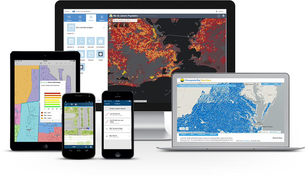
Create and share maps, analyses, and data
ArcGIS Desktop is the foundation of GIS.
ArcGIS Desktop is the key to realize location awareness advantages. Collect and manage data, create professional maps, perform traditional and advanced spatial analysis, and solve practical problems. Impact your organization, community, and the world and add value to your tangible assets.
Powerful desktop GIS
Let professional software take over your heavy burden. The two main desktop applications for GIS professionals are ArcMap and ArcGIS Pro, and both are part of ArcGIS Desktop. Each application has unique capabilities that meet your needs. It can create everything from simple web maps to complex analysis models.
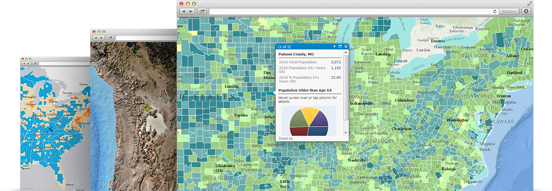
Create and design maps and 3D scenes
If a picture is worth a thousand words, a related map is worth a thousand pictures. Use the 2D map and 3D scene created on your desktop to display the data in a novel way, and find the unobvious relationship, invalid range, trend and opportunity.
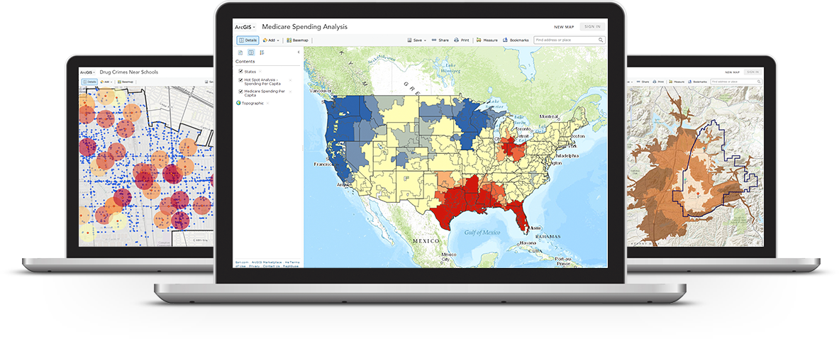
analysis
The world is full of unsolved problems. List these problems, analyze data, use various analysis tools to get results and check your work in 2D and 3D modes. ArcGIS Desktop has a rich analysis toolbox and modeling framework, enabling you to perform almost any type of spatial analysis.
Managing Geographic Data
Control everything. Use feature and form data, images, online maps, 3D data, and more to build, manage, and connect geographic information. Go to the next level to enable enterprise level collaboration and manage information collections throughout the organization through the ArcGIS platform.

image
Access ready to use images from the largest and most comprehensive collection in the world. With such an intelligent management system, it can be expanded to process massive data and identify the sensors you use every day.

Expand the scope of application
Deliver maps quickly and seamlessly to others and import them into their smartphones. Transform professional desktop data, maps and analysis into managed maps, analysis services, feature layers and image services. Use ArcGIS for Server and ArcGIS Online to provide administrative access to the entire organization.

3D GIS
The world is not flat, and you will no longer be confined to abstract concepts. Use 3D to view data from a realistic perspective, make better decisions, and communicate ideas more forcefully and effectively. ArcGIS Desktop will take you to enjoy 3D GIS.

Home Page: https://desktop.arcgis.com/zh-cn/
Download address
Geographic map development tool ESRI ArcGIS Desktop 10.8.2+Extensions x64
https://www.123pan.com/s/PjcA-ieDRA.html
https://pan.baidu.com/s/1FV8QqUbqLDdLplUZN6crPw?pwd=3l6u
https://pan.xunlei.com/s/VNxO9fvYk76q9hL8ynCseBnmA1?pwd=8ufb#