Ovi Interactive Map browser It is a powerful map browser software that allows you to quickly view detailed landmark routes around the world Baidu Maps 、 Google Maps 、 Sogou Map Wait, it's very helpful for people who like to read maps! This website sincerely recommends for you!
Official Profile
Ovi Interactive Map Browser is a cross platform map browser based on Google API, Baidu API and Sogou API developed by Beijing Yuansheng Huawang Company. It supports ios (iPhone, iPad), android, windows, winphone and Web.
The Ovi browser integrates a variety of well-known maps, has powerful design functions and geographic information presentation technology, and can meet the needs of geographic information planning in all walks of life. It is not only a good helper for your work, but also the best partner for you to explore the unknown world.
Features
1. 3D map
Automatically carry out fast 3D modeling by combining satellite image and elevation data. The excellent 3D loading and display engine can show you the world's real terrain smoothly.
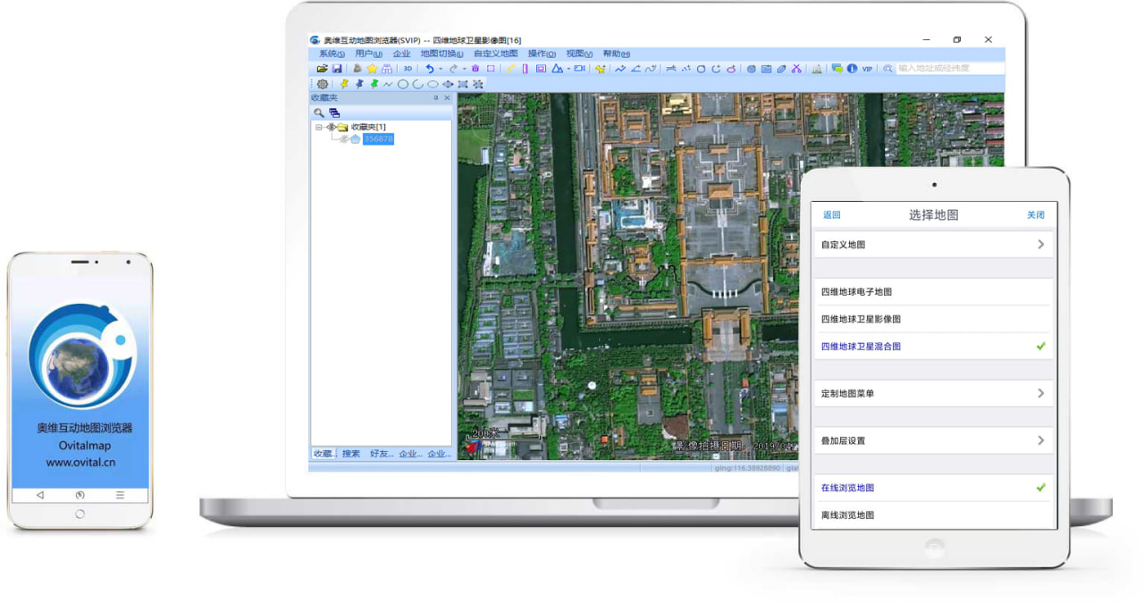
2. Support multiple well-known maps at the same time
At present, Google Maps, Satellite Maps, Bing Satellite Maps, Baidu Maps, Sogou Maps and other well-known maps have been integrated. Users can switch freely and download these maps offline.
3. autocad seamless docking
Ovi browser can directly read CAD design files and convert them into Ovi objects, showing your design on the map; You can also directly convert Ovi browser pictures and Ovi objects into CAD base maps and vector objects, allowing you to further fine design on CAD.
4. Elevation data service
Ovi browser cloud is integrated with SRTM3 global elevation data, so you can quickly query the altitude of any position in the world. The elevation data service of Ovi Browser can also directly output the contour lines with a precision of 10 meters on the satellite map, so that you can intuitively understand the altitude information when viewing the satellite map.
5. Geographic Planning
Ovi browser provides you with common tools for planning and design. You can directly do various planning and design on the map -- draw points, lines, polygons, circles, curves, marks, fill areas, and so on.
6. Big data support
Allow to display millions of Orville objects on the map at the same time; It supports up to 256TB of massive map data. The extremely excellent map display engine allows you to be unimpeded in the era of big data.
7. Location and track sharing
Share your walking path with friends; You can also guide your friends to get out of the way according to the shared location! Keep track of friends' positions, talk at any time, and know their positions in time.
8. Cross platform
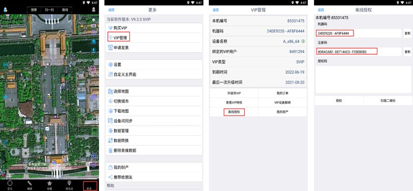
It fully supports mainstream platforms such as Microsoft, Apple, Android, etc. Your various geographical planning designs on PC can be quickly synchronized to the mobile platform, and the data collected on the mobile end can also be quickly synchronized to the computer.
Update description
V9.7.0 update:
1. Object export supports setting coordinate types: CGCS2000 and GCJ02
2. Bug repair and function optimization
V9.6.0 update:
1. Replace IE with Edge for built-in browser (64 bit version only)
2. Support rapid editing of coordinate points
3. Support serial number upgrade VIP
4. Support DXF file annotation
5. Support the latest version of slpk files
6. Other bug fixes and function optimization
V9.3.8 Update:
1. Support user-defined 3D text, support setting 3D font, rotation angle, elevation angle, background, etc
2. The third-party format conversion plug-in is supported when exporting objects, allowing users to export custom formats or modify the exported content
3. Support new 3D model format: 3dtiles (b3dm+json) format
4. Support mobile phone scanning login (mobile phone version needs to be updated to 9.3.7)
5. Bug repair and function optimization
V9.1.3 Update:
1. New four-dimensional earth satellite map and hybrid map
2. Partial bug repair and function optimization
V8.7.0 update:
1. VIP scheme adjustment
2. Partial bug repair and function optimization