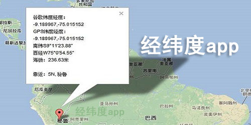
Longitude and latitude app
computer
Android
Reason for recommendation: The mobile version of longitude and latitude query and conversion is a mobile tool that provides longitude and latitude query services. Users can find the corresponding gps information with one key by just entering the address. The longitude and latitude information is clear at a glance, and the introduction is very detailed, which can help you quickly navigate to the designated location, which is very convenient. If you need it, please download it! Introduction to longitude and latitude query and conversion app: longitude and latitude query and conversion Reason for recommendation: The official version of Jingwei Altitude is a mobile tool that provides longitude, latitude and altitude information. The interface is clean and tidy, which can help users accurately locate, obtain and clearly understand their own geographical location information in real time. It has rich and powerful functions. There are more apps that can query longitude and latitude, and interested partners can come to download them! Introduction to longitude and latitude altitude software: longitude and latitude altitude is a real-time geographic location Reason for recommendation: As an application tool for altitude measurement, gps altimeter has powerful and rich functions. It not only has a built-in compass function, which allows you to easily obtain unknown direction and longitude and latitude information, but also supports map navigation, can measure altitude in real time, and provides weather forecast function. It is very comprehensive and worth recommending. Don't miss your favorite partner! Introduction to GPS altimeter app: GPS altimeter Reason for recommendation: As a powerful measuring tool, the mobile version of gps altimeter can measure the altitude information at any time, display the current longitude, latitude and address information, and accurately locate the current direction in real time through the compass. It also supports network sharing, which is very convenient. Do you want to experience it? Why not download and use it now! Introduction to the latest version of gps altimeter Reason for recommendation: Real time altimeter software is a measurement and positioning tool that many outdoor tourists like to use. It can help you accurately and quickly obtain the altitude, longitude and latitude of the location, quickly find the direction through the built-in compass, and easily know your speed through the speedometer. It is simple and convenient to use! Introduction to the latest version of real-time altimeter: This is a travel, outdoor Reason for recommendation: GPS Real time Altitude Mobile app, as a tool for mobile phones to measure GPS, can not only measure the altitude accurately in real time, but also provide mobile phone compass, satellite map positioning and other functions. It can take a panoramic view of the real scene, help you plan outdoor routes in time, and record information whenever and wherever you want, especially suitable for outdoor travel enthusiasts! Introduction to the latest version of gps real-time altitude Reason for recommendation: The official version of longitude and latitude positioning is a very special mobile phone positioning software. With this app, you can locate more accurately. Not only the approximate location can be displayed, but also the detailed longitude and latitude coordinates can be detected. In addition, the software also has a compass and camera functions. After taking photos, longitude and latitude watermarks will be automatically generated. If you are curious, please download and try! Longitude and latitude positioning query software
