
Earth Latest Edition
-
App size: 54.9 MB -
Application language: Simplified Chinese -
Updated: 2024-05-08 -
Application type: Domestic software/travel -
Operating environment: Android -
Application level: -
Official homepage: -
Application manufacturer: Xiamen Chuangshi Thread Technology Co., Ltd
-
Introduction -
Download address -
Boutique recommendation -
Related software -
Netizen comments
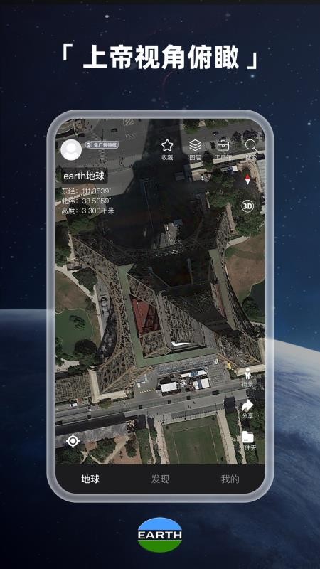
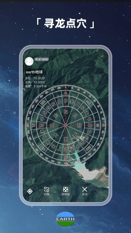
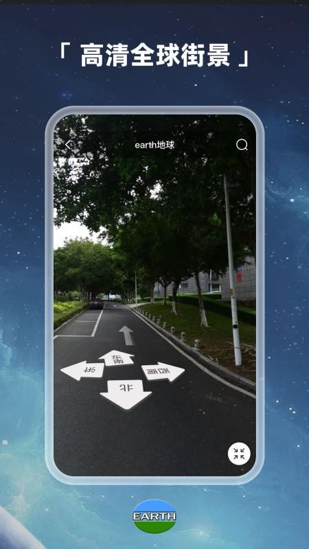
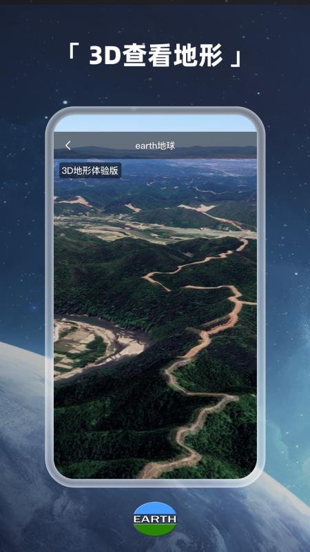
Application function
Application features
Application advantages
Update log

Download address
-
Android
Earth's latest version v3.9.7 Android
Related software
Netizen comments
Guess you like it
Earth Latest Edition 
Mobile version of the owner of incoming goods 
Jiutong Cloud Mobile Edition 
Tunnel eTong 2.0 
Tieyou train ticket app 
The latest edition of Shuiyun Tourism 
Haoyi Charging Post 
Haining Travel Official Edition 
Landau Taxi Driver Latest Edition 
Check out the travel app 
The latest version of Huacheng Smart Bus 
BYD Truck Android
Popular in this category
Popular Collections
-
download 
Shenzhen Aviation Software v6.0.1 87.1 MB / 2024-04-17 -
download 
Jixiang Airlines app v7.4.0 71.6 MB / 2024-04-05 -
download 
Hazelnut homestay appv7.24.1 54.7 MB / 2024-03-26 -
download 
Violation query payment assistant appv1.6.6 18.3 MB / 2023-12-25 -
download 
Spring and Autumn Tourism app v10.7.8 44.4 MB / 2023-12-21 -
download 
Ma Fengwo travel software v10.9.9 100 MB / 2023-09-08 -
download 
Mother Donkey Travel v8.8.97 49.4 MB / 2023-08-11 -
download 
Tuniu travel website appv10.95.0 93 MB / 2023-07-13 -
download 
Railway 12306 ticket booking software v5.6.0.8 83.7 MB / 2023-05-08 -
download 
Wheel latest v9.5.6 77.5 MB / 2023-04-05
This category of recommendation
-
one Shangri La hotel software v3.2.35 -
two Ctrip Ctrip app v8.69.2 -
three Spring Airlines mobile version v7.6.4 -
four High speed railway butler mobile version v8.6.6 -
five Weilai Auto app v5.24.8 -
six The latest version of jude rental v5.90.5.0067 -
seven Ruqi Travel Enterprise App v2.9.0 -
eight Agoda can reach appv12.00.0 -
nine Baidu Street View Map 2023 HD latest version v18.7.0 -
ten Baidu Maps app v18.7.0


Necessary for installation

Mobile Wifi master key app 
Mobile qq music app 
Mobile WeChat app 
Latest version of today's headlines 2022 
Mobile phone Kuwo music app 
Sogou IME 2022 latest version Railway 12306 ticket booking software 
Baidu Maps app 
Meituan group purchase app 
Rebate website app 
Kingsoft PowerWord Mobile Edition 
Ink Weather Mobile Edition


-
chat -
Mo Mo -
Mobile WeChat -
Mobile qq -
Exploration -
video -
Youku Video -
Tencent Video -
Mango tv -
IQIYI -
clip -
Ulead VideoStudio -
Love editing -
Powerful Director -
Cut and reflect -
music -
Kuwo Music -
Cool dog music -
NetEase cloud music -
Qq music -
browser -
360 Browser -
Ie browser -
Firefox -
Google Browser -
to work in an office -
wps -
Enterprise WeChat -
Nail -
office -
typewriting -
Five stroke input method -
Sogou input method -
Qq input method -
iFlytek Input -
P diagram -
Beautiful pictures -
photoshop -
nEO iMAGING -
lightroom -
Online disk -
115 network disk -
Celestial wing cloud disk -
Baidu online disk -
AliCloud disk -
mailbox -
Alibaba Email -
Qq mailbox -
outlook -
icloud -
Journalism -
Today's headlines -
Tencent News -
Hupu app -
NetEase News -
novel -
Fei Lu's novels -
Book chasing artifact -
Biqu Pavilion -
Migu Reading -
comic -
Tencent Animation -
First round -
Buka Comics -
Comic Island app -
Photography -
Watermark camera -
Daily p chart -
B612 camera -
Yitian Camera -
online shopping -
Idle fish -
Tmall app -
JD app -
Pinduoduo -
education -
Hujiang app -
Safety education platform -
Good score -
Seven day network -
healthy -
Vaccine app -
Yoga app -
Beauty app -
Registered app