
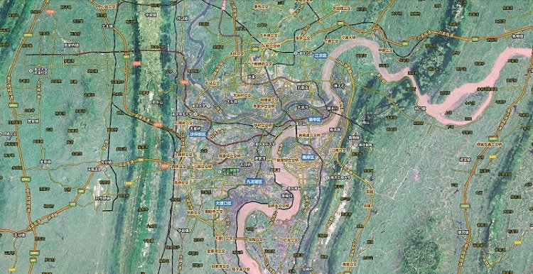
Chongqing Satellite Map 2019
-
Software size: 263.00 KB -
Software language: Simplified Chinese -
Updated: 2019-09-06 -
Software type: Domestic software/image browsing -
Operating environment: WinAll, WinXP, Win7, Win10 -
Software license: shareware -
Official homepage: http://www.xz7.com/ -
Software level:
-
Introduction -
Download address -
Boutique recommendation -
Related software -
Netizen comments
Introduction to Chongqing:

Location:
terrain:
Relevant description:
Download address
-
Pc version
Large Map of Chongqing Satellite Map 2019
Boutique recommendation
-
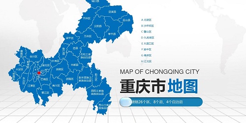
Chongqing map -
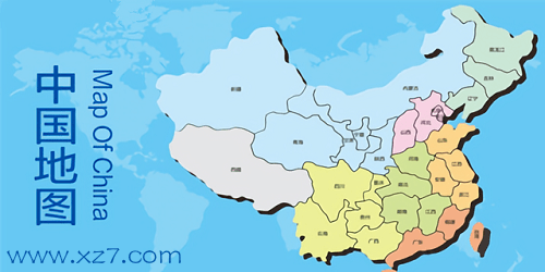
map of China -
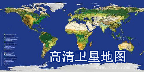
Satellite map
Chongqing map More+
-
Chongqing Tourism Map Full HD Edition Free Edition 852.00 KB / Simplified Chinese Free version download -

Travel Map app v5.3.0 Android 83.45 MB / Simplified Chinese V5.3.0 Android download -
Large new version of Chongqing Expressway Map 523.00 KB / Simplified Chinese Large download -
Chongqing Topography Map HD Free Edition 461.00 KB / Simplified Chinese Free version download -
Full HD Large Map of Chongqing Urban Traffic Map 483.00 KB / Simplified Chinese Large download -
Large Map of Chongqing Water System Map 237.00 KB / Simplified Chinese Large download -

Gaode Map app v15.00.0.2031 Android 265.63 MB / Simplified Chinese v15.00.0.2031 download -

Chongqing Metro Line Map 2021 Latest Version 302.00 KB / Simplified Chinese the latest version download
map of China More+
-
Gaode Map app v15.00.0.2031 Android 265.63 MB / Simplified Chinese v15.00.0.2031 download -
Mediterranean Map HD Large Free Edition 271.00 KB / Simplified Chinese Free version download -
World map HD 3 billion pixel electronic version 4.54 MB / Simplified Chinese electronic download -

Shuijingzhu Universal Map Downloader Free Version v4.1.25.13683 Official Version 92.80 MB / Simplified Chinese V4.1.25.13683 Official Edition download -
Southeast Asia Map HD Large Free Edition 276.00 KB / Simplified Chinese Free version download -
Kunming Tourism Map HD Large Map Free Edition 344.00 KB / Simplified Chinese Free version download -
Large high-definition tourist map of Guiyang 311.00 KB / Simplified Chinese Large download
Satellite map More+
-
Fujian Satellite Map HD 2019 Free Edition 244.00 KB / Simplified Chinese Free version download -
Large high-definition map of Sichuan satellite map 225.00 KB / Simplified Chinese Large download -
Yunnan Satellite Map HD 2019 Large Map 238.00 KB / Simplified Chinese Large download -
Large high-definition full map of Macao satellite map 201.00 KB / Simplified Chinese Large download -
Large high-definition map of Ningxia satellite map 145.00 KB / Simplified Chinese Large download -
Qinghai Satellite Map Full HD Edition Free Edition 209.00 KB / Simplified Chinese Free version download -
Large high-definition map of Hong Kong satellite map 172.00 KB / Simplified Chinese Large download -

Google Satellite Map HD latest v25.6.0.0 green version 37.85 MB / Simplified Chinese V25.6.0.0 Green Edition download
Netizen comments
Ranking in this category
-
one High definition wallpapers with pictures of Chinese national flag -
two Imageglass Chinese v9.1.7.627 -
three Full high-definition large map of China's provinces -
four Full map of China high-definition magnifiable version (including all provinces and cities) -
five WxDatViewer (WeChat dat image decoding software) v2.7 official version -
six Cad quick view v5.4 computer version -
seven Large high-definition version of China Tourism Map -
eight High definition version of Middle East map Large enlarged version -
nine Large picture of ultra-high definition version of the world map -
ten Guizhou Tourism Map Full HD Edition Free Edition
This category of recommendation
-
one Abc official version v3.3.1.5 latest version -
two Xnview green version v2.49.5 Chinese version -
three C93 eyecatch04 Official album -
four Kaniu map software v1.3.0.1006 green version -
five Pdf Quick View Green Version v1.9.0.0 Free Version -
six Graphml viewer v1.6.2 computer version -
seven Flash player v24.0.0.221 official version -
eight Picasa3 Chinese version v3.9.141.259 official version -
nine Picview Image Browser v1.0 Official Version -
ten Acdsee8 official v8.0 computer version


Necessary for installation
-

WinRAR official 64 bit -

Google Chrome -

ITunes 32-bit -

Sogou Pinyin Input Method Computer Version -

Kugou Music Player PC Edition -

360 security guard computer version -

IQIYI pps video client -

Baidu online disk PC version -

Tencent Computer Housekeeper Win10 Special Edition -

WeChat 2024 latest computer version -

Tencent app pc -

Wps office 2016 professional edition


-
chat -
Qq computer version -
WeChat computer version -
Yy voice -
skype -
video -
Tencent Video -
IQIYI -
Youku Video -
Mango tv -
clip -
Love editing -
Cut and reflect -
Ulead VideoStudio -
adobe premiere -
music -
Qq music -
NetEase cloud music -
Cool dog music -
Kuwo Music -
browser -
360 Browser -
Google Browser -
Firefox -
Ie browser -
to work in an office -
Nail -
Enterprise WeChat -
wps -
office -
typewriting -
Sogou input method -
Qq input method -
Five stroke input method -
iFlytek Input -
compress -
360 Compression -
winrar -
winzip -
7z decompression software -
translate -
Google Translate -
Baidu Translate -
Jinshan Translation -
English to Chinese software -
Anti-Virus -
360 Antivirus -
360 Security Guard -
Tinder software -
Tencent Computer Housekeeper -
P diagram -
Beautiful pictures -
photoshop -
nEO iMAGING -
lightroom -
programming -
python -
C language software -
Java development tools -
vc6.0 -
Online disk -
Baidu online disk -
AliCloud disk -
115 network disk -
Celestial wing cloud disk -
download -
Thunder -
Qq cyclone -
Emule -
utorrent -
negotiable securities -
Huatai Securities -
gf securities -
Founder Securities -
Southwest Securities -
mailbox -
Qq mailbox -
outlook -
Alibaba Email -
icloud -
drive -
Drive sprite -
Drive life -
Network card driver -
Printer drive