
google earth win10 64bit
-
Software size: 63.47 MB -
Software language: Simplified Chinese -
Updated: 2021-01-30 -
Software type: Domestic software/transportation -
Operating environment: Win10 -
Software license: freeware -
Official homepage: http://www.xz7.com/ -
Software level:

World tourism navigation map software v6.0.3 Android version 
Map viewing software v2.6 Android 
Soso Street View Map Software (Tencent Maps) v9.22.0 Android latest version 
3d interactive street view map software v1.0.9 Android version 
Explore the world map software v4.3.5 Android mobile version 
Norwegian map software v1.0.2 Android mobile version
-
Introduction -
Download address -
Boutique recommendation -
Related software -
Netizen comments
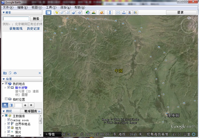
Introduction to Google Earth win10:

The latest version of google earth win10 features:
Common skills:
Download address
-
Pc version
Google earth win10 64bit v7.3.3 official version
Netizen comments
Ranking in this category
-
one Kailide car navigation map upgrade package v2.0.4.0 -
two Content manager launcher v2023 official version -
three Shenzhen Metro 2030 Latest Planning (HD) Ultimate -
four Understanding Chedi's official version of v6.9.3 -
five Official version of offline map data package of Gaode Map -
six Sogou map pc version v10.6.5 computer version -
seven Kailide mobile navigation system c-car version v6.0 official version -
eight Vissim traffic simulation software 8.0v8.0 Chinese version -
nine Ovi Interactive Map Browser computer version 32/64 bit v9.9.8 official latest version -
ten Shanghai Rail Transit 2030 Operation Diagram HD Version
This category of recommendation
-
one Ovi Interactive Map Browser computer version 32/64 bit v9.9.8 official latest version -
two Guizhou Traffic Police PC Version v5.91 Computer Version -
three Xinlan 12306 Ticket Booking Assistant v1.0.0.3095 Official Latest Version -
four Sogou map pc version v10.6.5 computer version -
five Google Earth Pro Computer Version v7.3 Official Version -
six Google earth computer installation package v7.3.3 pc latest version -
seven Feixiang parking lot charging software computer version -
eight Shouqi Car hailing PC Version v8.0.28 Latest Version -
nine Tencent map pc version v9.3.0 official version -
ten Mapwise Computer Version v1.1.4 Official Version


Necessary for installation
-

WinRAR official 64 bit -

Google Chrome -

ITunes 32-bit -

Sogou Pinyin Input Method Computer Version -

Kugou Music Player PC Edition -

360 security guard computer version -

IQIYI pps video client -

Baidu online disk PC version -

Tencent Computer Housekeeper Win10 Special Edition -

WeChat 2024 latest computer version -

Tencent app pc -

Wps office 2016 professional edition


-
chat -
Qq computer version -
WeChat computer version -
Yy voice -
skype -
video -
Tencent Video -
IQIYI -
Youku Video -
Mango tv -
clip -
Love editing -
Cut and reflect -
Ulead VideoStudio -
adobe premiere -
music -
Qq music -
NetEase cloud music -
Cool dog music -
Kuwo Music -
browser -
360 Browser -
Google Browser -
Firefox -
Ie browser -
to work in an office -
Nail -
Enterprise WeChat -
wps -
office -
typewriting -
Sogou input method -
Qq input method -
Five stroke input method -
iFlytek Input -
compress -
360 Compression -
winrar -
winzip -
7z decompression software -
translate -
Google Translate -
Baidu Translate -
Jinshan Translation -
English to Chinese software -
Anti-Virus -
360 Antivirus -
360 Security Guard -
Tinder software -
Tencent Computer Housekeeper -
P diagram -
Beautiful pictures -
photoshop -
nEO iMAGING -
lightroom -
programming -
python -
C language software -
Java development tools -
vc6.0 -
Online disk -
Baidu online disk -
AliCloud disk -
115 network disk -
Celestial wing cloud disk -
download -
Thunder -
Qq cyclone -
Emule -
utorrent -
negotiable securities -
Huatai Securities -
gf securities -
Founder Securities -
Southwest Securities -
mailbox -
Qq mailbox -
outlook -
Alibaba Email -
icloud -
drive -
Drive sprite -
Drive life -
Network card driver -
Printer drive