Earth 2024 It is a 3D satellite globe mobile phone software, which is very suitable for learning geography related knowledge. It can help you in an intuitive way. All the global geographical information is included, and you can also view detailed geographical features, so that you can not only learn relevant knowledge, but also browse the world without leaving home!
Introduction to earth mobile version
With the 3D satellite globe, users can learn a lot of geographical knowledge by using the earth app. It provides map models, day and night models, popular logos, multi search models, and satellite models. It allows us to explore rich geographical knowledge more intuitively, save the places you have visited, and share with others. Use the new "Tour Guide" function to easily explore exciting new places. Simply swipe the tabs at the bottom of the screen to browse a selection of virtual travel routes around the world.

Features of earth official edition
1. Provide comprehensive and accurate maps of 220 countries/regions
2. Bus routes and maps of more than 15000 towns
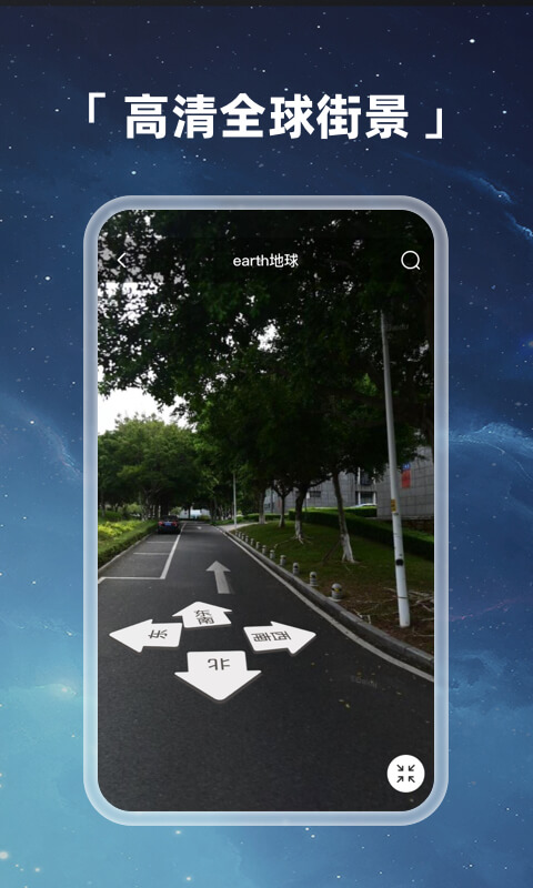
3. Provide 2265 street scenes and indoor images of restaurants, museums and other places
4. Provide real-time road condition information, accident report and automatic route reselection function to help you find the best route
5. Provide details of more than 100 million locations
6. GPS voice navigation for driving, cycling and walking routes
App highlights
Multi ball mode: In geography class, students can see the difference between land plate and ocean;
Satellite mode: Satellite images need to be loaded for a long time. When using, wait patiently for Google Earth data tiles to load;
Map mode: Teach you to know each country on the world map;
Day night model: Read the cool day and night appearance of the earth's rotation;
Popular logo: Check the characteristics of science popularization in different places on the earth, such as giant pandas, Potala Palace, etc;
software function
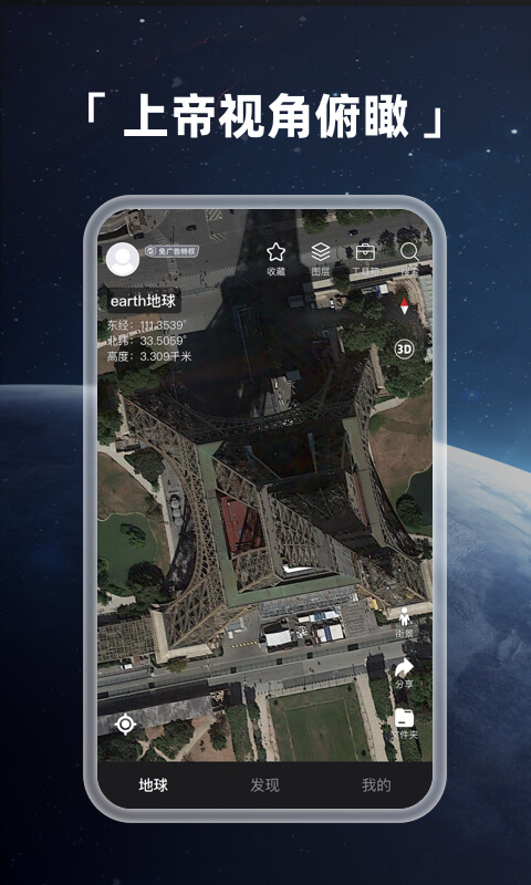
Longitude and latitude:
You can enter longitude and latitude to quickly locate to the streetscape ground without using ourplay Or Google Space;
Satellite layer and road network navigation map:
Integrated Google Maps , Google Maps, Hybrid Maps Celestial map , Baidu api, Tencent Street View, Gaode poi, arcgis are faster than traditional Ovi Interactive Map Faster and clearer;
Map browser :
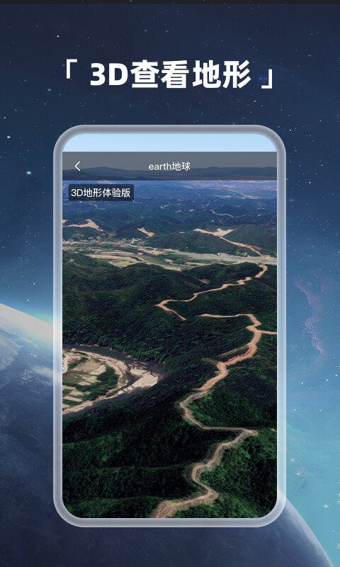
Driving in the field with satellite map to find the way; 3D terrain mountain shape
Geographic planning:
Kml and kmz files can be imported. Later, cad files can be submitted for surveying and other gps toolbox functions
Satellite navigation:
Find the roof of your home through compass correctable satellite navigation;
Geographic science popularization:
The day night model can show the dynamic effect of the dawn dusk line of the 3D new satellite Earth;
Tracks and other features:
When positioning, you will experience the flight path falling on the surface of the world map; Compass;
Massive data:
The high-definition map data of a single year of global historical image data is 70tb, and big data supports Google Space;
How to use earth mobile phone version?
[How to navigate]
1. Open the app and click the magnifying glass button on the top right of the software.

2. Enter the destination we want to go to to start navigation.

[How to see the street scene]
1. Open the software and click the three bar button icon on the top left of the software.

2. Click the [Select Image Source] function to select the image source we want to use.

3. Finally, click the [Street View] function button to view the street view.

[How to import data]
1. First, we need to find the file we want to import, and then click [Use Other Applications] to open the button.

2. Then, select our earth APP and open it to complete the file import.

Update log
V3.9.3
1. Fix the dxf import offset problem and optimize the experience
V3.7.8
Fix cache errors Can't delete old data
V3.7.1 Version
Fix known problems
V3.6.5
1. New 3D building goes online
V2.8.9
Optimize and upgrade
V2.8.2
Upgrade HD data
V2.7.9
Upgrade core and optimize user experience
V2.7.0
1. Add in app navigation
2. Add positioning disc
3. Fix the longitude and latitude display problem
4. Adjust the upper limit of favorite point naming
V2.6.1 Version:
1. New Celestial Centerline Rotation Function
2. New Longitude and Latitude Clear
V2.5.9
1. Optimize navigation and jump to other applications;
2. Add the function of user-defined compass;
3. Add Home+- button
V2.5.7
1. New global search